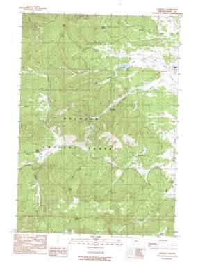
Logdell Topo Map Oregon
To zoom in, hover over the map of Logdell
USGS Topo Quad 44119b2 - 1:24,000 scale
| Topo Map Name: | Logdell |
| USGS Topo Quad ID: | 44119b2 |
| Print Size: | ca. 21 1/4" wide x 27" high |
| Southeast Coordinates: | 44.125° N latitude / 119.125° W longitude |
| Map Center Coordinates: | 44.1875° N latitude / 119.1875° W longitude |
| U.S. State: | OR |
| Filename: | o44119b2.jpg |
| Download Map JPG Image: | Logdell topo map 1:24,000 scale |
| Map Type: | Topographic |
| Topo Series: | 7.5´ |
| Map Scale: | 1:24,000 |
| Source of Map Images: | United States Geological Survey (USGS) |
| Alternate Map Versions: |
Logdell OR 1990, updated 1990 Download PDF Buy paper map Logdell OR 2011 Download PDF Buy paper map Logdell OR 2014 Download PDF Buy paper map |
| FStopo: | US Forest Service topo Logdell is available: Download FStopo PDF Download FStopo TIF |
1:24,000 Topo Quads surrounding Logdell
> Back to 44119a1 at 1:100,000 scale
> Back to 44118a1 at 1:250,000 scale
> Back to U.S. Topo Maps home
Logdell topo map: Gazetteer
Logdell: Dams
Sproul Dam elevation 1476m 4842′Logdell: Post Offices
Duncanville Post Office (historical) elevation 1463m 4799′Logdell Post Office (historical) elevation 1458m 4783′
Logdell: Reservoirs
Lost Creek Reservoir elevation 1500m 4921′Sproul Reservoir elevation 1476m 4842′
Logdell: Springs
Keller Spring elevation 1599m 5246′Ninety Six Spring elevation 1510m 4954′
Oxbow Spring elevation 1559m 5114′
Poison Spring elevation 1695m 5561′
Roads End Spring elevation 1753m 5751′
Sproul Spring elevation 1556m 5104′
Station Spring elevation 1573m 5160′
Logdell: Streams
Cold Creek elevation 1512m 4960′Dipping Vat Creek elevation 1486m 4875′
Flagtail Creek elevation 1571m 5154′
Hay Creek elevation 1461m 4793′
Hog Creek elevation 1597m 5239′
Little Snowshoe Creek elevation 1565m 5134′
Lost Creek elevation 1481m 4858′
Luce Creek elevation 1451m 4760′
Snow Creek elevation 1527m 5009′
Snowshoe Creek elevation 1545m 5068′
Swamp Creek elevation 1493m 4898′
Wickiup Creek elevation 1536m 5039′
Logdell: Summits
Oxbow Butte elevation 1662m 5452′Logdell: Valleys
Rail Gulch elevation 1462m 4796′Logdell digital topo map on disk
Buy this Logdell topo map showing relief, roads, GPS coordinates and other geographical features, as a high-resolution digital map file on DVD:


