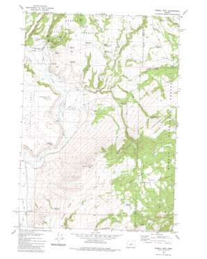
Powell Mountain Topo Map Oregon
To zoom in, hover over the map of Powell Mountain
USGS Topo Quad 44119b6 - 1:24,000 scale
| Topo Map Name: | Powell Mountain |
| USGS Topo Quad ID: | 44119b6 |
| Print Size: | ca. 21 1/4" wide x 27" high |
| Southeast Coordinates: | 44.125° N latitude / 119.625° W longitude |
| Map Center Coordinates: | 44.1875° N latitude / 119.6875° W longitude |
| U.S. State: | OR |
| Filename: | o44119b6.jpg |
| Download Map JPG Image: | Powell Mountain topo map 1:24,000 scale |
| Map Type: | Topographic |
| Topo Series: | 7.5´ |
| Map Scale: | 1:24,000 |
| Source of Map Images: | United States Geological Survey (USGS) |
| Alternate Map Versions: |
Powell Mtn OR 1981, updated 1981 Download PDF Buy paper map Powell Mtn OR 1992, updated 1997 Download PDF Buy paper map Powell Mountain OR 2011 Download PDF Buy paper map Powell Mountain OR 2014 Download PDF Buy paper map |
| FStopo: | US Forest Service topo Powell Mountain is available: Download FStopo PDF Download FStopo TIF |
1:24,000 Topo Quads surrounding Powell Mountain
> Back to 44119a1 at 1:100,000 scale
> Back to 44118a1 at 1:250,000 scale
> Back to U.S. Topo Maps home
Powell Mountain topo map: Gazetteer
Powell Mountain: Canals
Palmer Ditch elevation 1201m 3940′Powell Mountain: Cliffs
Stockade Point elevation 1252m 4107′Powell Mountain: Flats
Christiansen Lake elevation 1233m 4045′Sunflower Flats elevation 1547m 5075′
Powell Mountain: Reservoirs
Bear Butte Reservoir elevation 1397m 4583′Bellworm Reservoir elevation 1344m 4409′
Boundary Reservoir elevation 1309m 4294′
Bronco Reservoir elevation 1323m 4340′
Division Reservoir elevation 1406m 4612′
Duck Puddle Reservoir elevation 1341m 4399′
Hawk Reservoir elevation 1347m 4419′
Heisler Reservoir Number One elevation 1304m 4278′
Heisler Reservoir Number Two elevation 1296m 4251′
Middle Bronco Reservoir elevation 1332m 4370′
Palmer Reservoir elevation 1372m 4501′
Pine Tree Reservoir elevation 1380m 4527′
Rock Spring Reservoir elevation 1356m 4448′
Stump Creek Reservoir elevation 1447m 4747′
Thompson Reservoir elevation 1571m 5154′
Turnpike Reservoir elevation 1359m 4458′
Upper Bronco Reservoir elevation 1351m 4432′
Powell Mountain: Ridges
Ashley Ridge elevation 1571m 5154′Hardscrabble Ridge elevation 1599m 5246′
Treichel Ridge elevation 1476m 4842′
Powell Mountain: Springs
Bob Spring elevation 1310m 4297′Cold Spring elevation 1510m 4954′
Rager Spring elevation 1248m 4094′
Suplee Spring elevation 1631m 5351′
Telephone Spring elevation 1545m 5068′
Powell Mountain: Streams
Bear Creek elevation 1219m 3999′Beaverdam Creek elevation 1218m 3996′
Black Stump Creek elevation 1273m 4176′
Bronco Creek elevation 1218m 3996′
Heisler Creek elevation 1218m 3996′
Powell Creek elevation 1215m 3986′
Rager Creek elevation 1200m 3937′
Tamarack Creek elevation 1185m 3887′
Powell Mountain: Summits
Bear Butte elevation 1452m 4763′Powell Mountain elevation 1611m 5285′
Powell Mountain: Valleys
Bellworm Canyon elevation 1254m 4114′Monroe Draw elevation 1427m 4681′
Powell Valley elevation 1194m 3917′
Powell Mountain digital topo map on disk
Buy this Powell Mountain topo map showing relief, roads, GPS coordinates and other geographical features, as a high-resolution digital map file on DVD:


