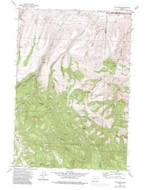
Day Basin Topo Map Oregon
To zoom in, hover over the map of Day Basin
USGS Topo Quad 44119d6 - 1:24,000 scale
| Topo Map Name: | Day Basin |
| USGS Topo Quad ID: | 44119d6 |
| Print Size: | ca. 21 1/4" wide x 27" high |
| Southeast Coordinates: | 44.375° N latitude / 119.625° W longitude |
| Map Center Coordinates: | 44.4375° N latitude / 119.6875° W longitude |
| U.S. State: | OR |
| Filename: | o44119d6.jpg |
| Download Map JPG Image: | Day Basin topo map 1:24,000 scale |
| Map Type: | Topographic |
| Topo Series: | 7.5´ |
| Map Scale: | 1:24,000 |
| Source of Map Images: | United States Geological Survey (USGS) |
| Alternate Map Versions: |
Day Basin OR 1972, updated 1976 Download PDF Buy paper map Day Basin OR 1972, updated 1985 Download PDF Buy paper map Day Basin OR 1992, updated 1997 Download PDF Buy paper map Day Basin OR 2011 Download PDF Buy paper map Day Basin OR 2014 Download PDF Buy paper map |
| FStopo: | US Forest Service topo Day Basin is available: Download FStopo PDF Download FStopo TIF |
1:24,000 Topo Quads surrounding Day Basin
> Back to 44119a1 at 1:100,000 scale
> Back to 44118a1 at 1:250,000 scale
> Back to U.S. Topo Maps home
Day Basin topo map: Gazetteer
Day Basin: Basins
Cottonwood Basin elevation 969m 3179′Day Basin elevation 1349m 4425′
Day Basin: Flats
Big Bedground elevation 1309m 4294′McClanahan Meadow elevation 1809m 5935′
Day Basin: Post Offices
Barite Post Office (historical) elevation 1216m 3989′Day Basin: Ridges
A and M Ridge elevation 1639m 5377′Cougar Ridge elevation 1723m 5652′
Day Basin: Springs
Breathing Spring elevation 1317m 4320′China Camp Spring elevation 1395m 4576′
Home Sweet Home Spring elevation 1280m 4199′
Tin Cup Spring elevation 1326m 4350′
Day Basin: Streams
Back Creek elevation 1251m 4104′Cougar Creek elevation 1304m 4278′
Day Creek elevation 940m 3083′
Dyke Creek elevation 978m 3208′
East Birch Creek elevation 1179m 3868′
East Fork Cottonwood Creek elevation 1105m 3625′
Lost Cabin Creek elevation 1494m 4901′
West Birch Creek elevation 1216m 3989′
Day Basin: Summits
Windy Point elevation 2063m 6768′Day Basin: Valleys
Kangaroo Basin elevation 1074m 3523′Red Gulch elevation 887m 2910′
Still Gulch elevation 1017m 3336′
Tennessee Gulch elevation 901m 2956′
Day Basin digital topo map on disk
Buy this Day Basin topo map showing relief, roads, GPS coordinates and other geographical features, as a high-resolution digital map file on DVD:


