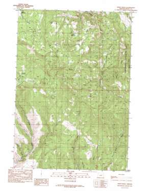
Sheep Ridge Topo Map Oregon
To zoom in, hover over the map of Sheep Ridge
USGS Topo Quad 44119e4 - 1:24,000 scale
| Topo Map Name: | Sheep Ridge |
| USGS Topo Quad ID: | 44119e4 |
| Print Size: | ca. 21 1/4" wide x 27" high |
| Southeast Coordinates: | 44.5° N latitude / 119.375° W longitude |
| Map Center Coordinates: | 44.5625° N latitude / 119.4375° W longitude |
| U.S. State: | OR |
| Filename: | o44119e4.jpg |
| Download Map JPG Image: | Sheep Ridge topo map 1:24,000 scale |
| Map Type: | Topographic |
| Topo Series: | 7.5´ |
| Map Scale: | 1:24,000 |
| Source of Map Images: | United States Geological Survey (USGS) |
| Alternate Map Versions: |
Sheep Ridge OR 1990, updated 1990 Download PDF Buy paper map Sheep Ridge OR 1999, updated 2002 Download PDF Buy paper map Sheep Ridge OR 2011 Download PDF Buy paper map Sheep Ridge OR 2014 Download PDF Buy paper map |
| FStopo: | US Forest Service topo Sheep Ridge is available: Download FStopo PDF Download FStopo TIF |
1:24,000 Topo Quads surrounding Sheep Ridge
> Back to 44119e1 at 1:100,000 scale
> Back to 44118a1 at 1:250,000 scale
> Back to U.S. Topo Maps home
Sheep Ridge topo map: Gazetteer
Sheep Ridge: Basins
Timber Basin elevation 1258m 4127′Sheep Ridge: Flats
Grizzly Flats elevation 1513m 4963′McGarr Meadows elevation 1441m 4727′
Rudio Meadows elevation 1580m 5183′
Sheep Ridge: Ridges
Sheep Ridge elevation 1684m 5524′Sheep Ridge: Springs
Cold Spring elevation 1638m 5374′Willow Spring elevation 1574m 5164′
Sheep Ridge: Streams
Board Creek elevation 1244m 4081′Burton Creek elevation 1114m 3654′
Squaw Creek elevation 1029m 3375′
Sheep Ridge: Summits
Lost Boy Butte elevation 1295m 4248′Rudio Mountain elevation 1691m 5547′
Sheep Ridge: Valleys
Baker City Gulch elevation 956m 3136′Pine Hollow elevation 1039m 3408′
Sheep Ridge digital topo map on disk
Buy this Sheep Ridge topo map showing relief, roads, GPS coordinates and other geographical features, as a high-resolution digital map file on DVD:


