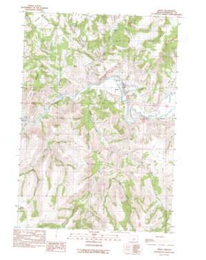
Spray Topo Map Oregon
To zoom in, hover over the map of Spray
USGS Topo Quad 44119g7 - 1:24,000 scale
| Topo Map Name: | Spray |
| USGS Topo Quad ID: | 44119g7 |
| Print Size: | ca. 21 1/4" wide x 27" high |
| Southeast Coordinates: | 44.75° N latitude / 119.75° W longitude |
| Map Center Coordinates: | 44.8125° N latitude / 119.8125° W longitude |
| U.S. State: | OR |
| Filename: | o44119g7.jpg |
| Download Map JPG Image: | Spray topo map 1:24,000 scale |
| Map Type: | Topographic |
| Topo Series: | 7.5´ |
| Map Scale: | 1:24,000 |
| Source of Map Images: | United States Geological Survey (USGS) |
| Alternate Map Versions: |
Spray OR 1990, updated 1990 Download PDF Buy paper map Spray OR 2011 Download PDF Buy paper map Spray OR 2014 Download PDF Buy paper map |
1:24,000 Topo Quads surrounding Spray
> Back to 44119e1 at 1:100,000 scale
> Back to 44118a1 at 1:250,000 scale
> Back to U.S. Topo Maps home
Spray topo map: Gazetteer
Spray: Airports
Spray Airstrip elevation 620m 2034′Spray: Parks
Spray Riverfront Park elevation 559m 1833′Spray: Populated Places
Spray elevation 546m 1791′Spray: Post Offices
Poplar Post Office (historical) elevation 547m 1794′Spray Post Office elevation 546m 1791′
Spray: Streams
Canyon Creek elevation 527m 1729′Corncob Creek elevation 631m 2070′
Cry Creek elevation 535m 1755′
Evans Creek elevation 679m 2227′
Haystack Creek elevation 538m 1765′
Holmes Creek elevation 586m 1922′
Kahler Creek elevation 537m 1761′
Left Hand Creek elevation 655m 2148′
Parrish Creek elevation 536m 1758′
Snabel Creek elevation 535m 1755′
Spray: Summits
Harper Mountain elevation 881m 2890′Sentinel Peak elevation 969m 3179′
Spray: Valleys
Balm Hollow elevation 707m 2319′Branson Canyon elevation 574m 1883′
Burton Canyon elevation 534m 1751′
Button Hollow elevation 794m 2604′
Haystack Valley elevation 538m 1765′
Laurel Hollow elevation 754m 2473′
Long Hollow elevation 565m 1853′
Slick Hollow elevation 654m 2145′
Town Gulch elevation 540m 1771′
Spray digital topo map on disk
Buy this Spray topo map showing relief, roads, GPS coordinates and other geographical features, as a high-resolution digital map file on DVD:


