Ritter Topo Map Oregon
To zoom in, hover over the map of Ritter
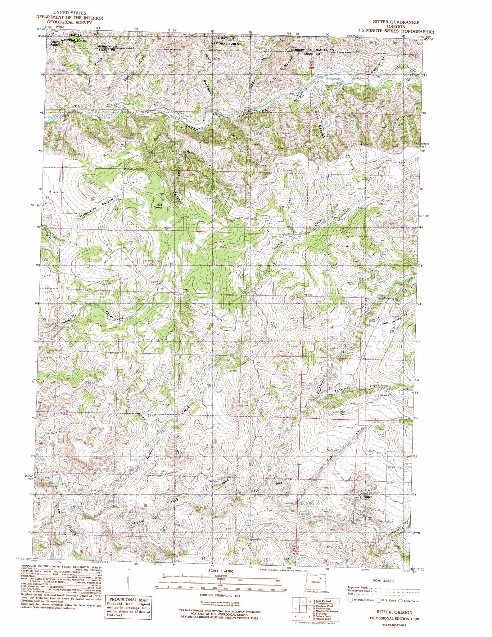
USGS Topo Quad 44119h2 - 1:24,000 scale
| Topo Map Name: | Ritter |
| USGS Topo Quad ID: | 44119h2 |
| Print Size: | ca. 21 1/4" wide x 27" high |
| Southeast Coordinates: | 44.875° N latitude / 119.125° W longitude |
| Map Center Coordinates: | 44.9375° N latitude / 119.1875° W longitude |
| U.S. State: | OR |
| Filename: | o44119h2.jpg |
| Download Map JPG Image: | Ritter topo map 1:24,000 scale |
| Map Type: | Topographic |
| Topo Series: | 7.5´ |
| Map Scale: | 1:24,000 |
| Source of Map Images: | United States Geological Survey (USGS) |
| Alternate Map Versions: |
Ritter OR 1990, updated 1990 Download PDF Buy paper map Ritter OR 1995, updated 1998 Download PDF Buy paper map Ritter OR 2011 Download PDF Buy paper map Ritter OR 2014 Download PDF Buy paper map |
| FStopo: | US Forest Service topo Ritter is available: Download FStopo PDF Download FStopo TIF |
1:24,000 Topo Quads surrounding Ritter
Summerfield Ridge |
Arbuckle Mountain |
Matlock Prairie |
Sugarbowl Creek |
Ukiah |
Madison Butte |
Lake Penland |
Thompson Flat |
Deerhorn Creek |
Bridge Creek |
Johnny Cake Mountain |
Slickear Mountain |
Ritter |
Meadow Brook Summit |
Dale |
Monument |
Steet Mountain |
Bullock Gulch |
Flowers Gulch |
Wildcat Point |
Courthouse Rock |
Hamilton |
Fox |
Long Creek |
Keeney Point |
> Back to 44119e1 at 1:100,000 scale
> Back to 44118a1 at 1:250,000 scale
> Back to U.S. Topo Maps home
Ritter topo map: Gazetteer
Ritter: Populated Places
Ritter elevation 777m 2549′Ritter: Post Offices
Ritter Post Office elevation 777m 2549′Ritter: Ridges
Devils Backbone elevation 980m 3215′Ritter: Springs
Mud Spring elevation 1168m 3832′Powell Hot Springs elevation 786m 2578′
Ritter Hot Springs elevation 777m 2549′
Ritter: Streams
Deer Creek elevation 718m 2355′Eightmile Creek elevation 759m 2490′
Fisher Creek elevation 763m 2503′
Iron Spring Creek elevation 973m 3192′
Long Creek elevation 708m 2322′
Monkey Creek elevation 718m 2355′
Schoolcraft Creek elevation 751m 2463′
Sixmile Creek elevation 714m 2342′
Skull Creek elevation 732m 2401′
Stony Creek elevation 733m 2404′
Thompson Creek elevation 849m 2785′
Twelvemile Creek elevation 785m 2575′
Ritter: Valleys
Burn Canyon elevation 752m 2467′Deep Canyon elevation 839m 2752′
Spring Hollow elevation 821m 2693′
Ritter digital topo map on disk
Buy this Ritter topo map showing relief, roads, GPS coordinates and other geographical features, as a high-resolution digital map file on DVD: