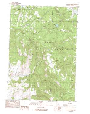
Whitetail Butte Topo Map Oregon
To zoom in, hover over the map of Whitetail Butte
USGS Topo Quad 44119h6 - 1:24,000 scale
| Topo Map Name: | Whitetail Butte |
| USGS Topo Quad ID: | 44119h6 |
| Print Size: | ca. 21 1/4" wide x 27" high |
| Southeast Coordinates: | 44.875° N latitude / 119.625° W longitude |
| Map Center Coordinates: | 44.9375° N latitude / 119.6875° W longitude |
| U.S. State: | OR |
| Filename: | o44119h6.jpg |
| Download Map JPG Image: | Whitetail Butte topo map 1:24,000 scale |
| Map Type: | Topographic |
| Topo Series: | 7.5´ |
| Map Scale: | 1:24,000 |
| Source of Map Images: | United States Geological Survey (USGS) |
| Alternate Map Versions: |
Whitetail Butte OR 1990, updated 1990 Download PDF Buy paper map Whitetail Butte OR 1995, updated 1998 Download PDF Buy paper map Whitetail Butte OR 2011 Download PDF Buy paper map Whitetail Butte OR 2014 Download PDF Buy paper map |
| FStopo: | US Forest Service topo Whitetail Butte is available: Download FStopo PDF Download FStopo TIF |
1:24,000 Topo Quads surrounding Whitetail Butte
> Back to 44119e1 at 1:100,000 scale
> Back to 44118a1 at 1:250,000 scale
> Back to U.S. Topo Maps home
Whitetail Butte topo map: Gazetteer
Whitetail Butte: Areas
Bull Prairie elevation 1256m 4120′Whitetail Butte: Basins
Kahler Basin elevation 818m 2683′Whitetail Butte: Dams
Bull Prairie Dam elevation 1243m 4078′Whitetail Butte: Flats
Rocky Flat elevation 1311m 4301′Wilson Prairie elevation 1117m 3664′
Whitetail Butte: Parks
Morrow County OHV Park elevation 1313m 4307′Whitetail Butte: Post Offices
Wagner Post Office (historical) elevation 918m 3011′Whitetail Butte: Reservoirs
Bull Prairie Lake elevation 1243m 4078′Whitetail Butte: Springs
Bull Prairie Spring elevation 1234m 4048′Cabin Spring elevation 1220m 4002′
Coffeepot Spring elevation 1275m 4183′
Del Spring elevation 1401m 4596′
Fairview Spring elevation 1305m 4281′
Gilman Spring elevation 1228m 4028′
Mud Spring elevation 1334m 4376′
Rock Spring elevation 1395m 4576′
Rocky Flat Spring elevation 1269m 4163′
Stalling Butte Spring elevation 1398m 4586′
Tamarack Spring elevation 1313m 4307′
Walker Spring elevation 1317m 4320′
Whitetail Spring elevation 1310m 4297′
Yearling Spring elevation 1255m 4117′
Whitetail Butte: Streams
Burnt Cabin Creek elevation 974m 3195′Dead Horse Creek elevation 775m 2542′
Johnson Creek elevation 1136m 3727′
Keating Creek elevation 1073m 3520′
Porter Creek elevation 1117m 3664′
Tamarack Creek elevation 880m 2887′
Whitetail Butte: Summits
Grassy Butte elevation 1322m 4337′Mahogany Butte elevation 1356m 4448′
Stalling Butte elevation 1430m 4691′
Whitetail Butte elevation 1386m 4547′
Whitetail Butte: Trails
Wall Creek Trail (historical) elevation 1196m 3923′Whitetail Butte digital topo map on disk
Buy this Whitetail Butte topo map showing relief, roads, GPS coordinates and other geographical features, as a high-resolution digital map file on DVD:


