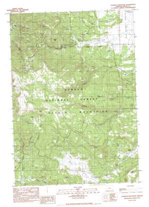
Lookout Mountain Topo Map Oregon
To zoom in, hover over the map of Lookout Mountain
USGS Topo Quad 44120c3 - 1:24,000 scale
| Topo Map Name: | Lookout Mountain |
| USGS Topo Quad ID: | 44120c3 |
| Print Size: | ca. 21 1/4" wide x 27" high |
| Southeast Coordinates: | 44.25° N latitude / 120.25° W longitude |
| Map Center Coordinates: | 44.3125° N latitude / 120.3125° W longitude |
| U.S. State: | OR |
| Filename: | o44120c3.jpg |
| Download Map JPG Image: | Lookout Mountain topo map 1:24,000 scale |
| Map Type: | Topographic |
| Topo Series: | 7.5´ |
| Map Scale: | 1:24,000 |
| Source of Map Images: | United States Geological Survey (USGS) |
| Alternate Map Versions: |
Lookout Mountain OR 1990, updated 1990 Download PDF Buy paper map Lookout Mountain OR 1992, updated 1997 Download PDF Buy paper map Lookout Mountain OR 1992, updated 1997 Download PDF Buy paper map Lookout Mountain OR 2011 Download PDF Buy paper map Lookout Mountain OR 2014 Download PDF Buy paper map |
| FStopo: | US Forest Service topo Lookout Mountain is available: Download FStopo PDF Download FStopo TIF |
1:24,000 Topo Quads surrounding Lookout Mountain
> Back to 44120a1 at 1:100,000 scale
> Back to 44120a1 at 1:250,000 scale
> Back to U.S. Topo Maps home
Lookout Mountain topo map: Gazetteer
Lookout Mountain: Flats
Gray Prairie elevation 1532m 5026′Lookout Mountain: Mines
Amity Mine elevation 1512m 4960′Blue Ridge Mine elevation 1500m 4921′
Independent Mine elevation 1748m 5734′
Lookout Mountain: Parks
Lookout Mountain Management Area elevation 1915m 6282′Lookout Mountain: Reservoirs
Lost Spring Reservoir elevation 1647m 5403′Lookout Mountain: Ridges
Lookout Mountain elevation 2109m 6919′Lutsey Point elevation 1677m 5501′
South Point elevation 2017m 6617′
Lookout Mountain: Springs
Biggs Spring elevation 1477m 4845′Buck Spring elevation 1857m 6092′
Chev Spring elevation 1845m 6053′
Crow Spring elevation 1651m 5416′
Goldie Spring elevation 1548m 5078′
Kemp Spring elevation 1597m 5239′
Kyle Spring elevation 1761m 5777′
Little Spring elevation 1879m 6164′
Lookout Spring elevation 2034m 6673′
Lost Spring elevation 1657m 5436′
Lookout Mountain: Streams
Buck Creek elevation 1429m 4688′Cline Creek elevation 1433m 4701′
Cuitan Creek elevation 1525m 5003′
Fawn Creek elevation 1634m 5360′
Little Horse Heaven Creek elevation 1401m 4596′
Lodgepole Creek elevation 1537m 5042′
Lytle Creek elevation 1476m 4842′
Polie Creek elevation 1402m 4599′
Short Creek elevation 1528m 5013′
Spring Creek elevation 1459m 4786′
Winter Creek elevation 1434m 4704′
Lookout Mountain: Summits
Winter Butte elevation 1749m 5738′Lookout Mountain: Valleys
Horse Gulch elevation 1503m 4931′Lookout Mountain digital topo map on disk
Buy this Lookout Mountain topo map showing relief, roads, GPS coordinates and other geographical features, as a high-resolution digital map file on DVD:


