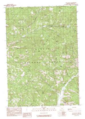
Salt Butte Topo Map Oregon
To zoom in, hover over the map of Salt Butte
USGS Topo Quad 44120d6 - 1:24,000 scale
| Topo Map Name: | Salt Butte |
| USGS Topo Quad ID: | 44120d6 |
| Print Size: | ca. 21 1/4" wide x 27" high |
| Southeast Coordinates: | 44.375° N latitude / 120.625° W longitude |
| Map Center Coordinates: | 44.4375° N latitude / 120.6875° W longitude |
| U.S. State: | OR |
| Filename: | o44120d6.jpg |
| Download Map JPG Image: | Salt Butte topo map 1:24,000 scale |
| Map Type: | Topographic |
| Topo Series: | 7.5´ |
| Map Scale: | 1:24,000 |
| Source of Map Images: | United States Geological Survey (USGS) |
| Alternate Map Versions: |
Salt Butte OR 1990, updated 1990 Download PDF Buy paper map Salt Butte OR 1992, updated 1997 Download PDF Buy paper map Salt Butte OR 2011 Download PDF Buy paper map Salt Butte OR 2014 Download PDF Buy paper map |
| FStopo: | US Forest Service topo Salt Butte is available: Download FStopo PDF Download FStopo TIF |
1:24,000 Topo Quads surrounding Salt Butte
> Back to 44120a1 at 1:100,000 scale
> Back to 44120a1 at 1:250,000 scale
> Back to U.S. Topo Maps home
Salt Butte topo map: Gazetteer
Salt Butte: Cliffs
Brennan Palisades elevation 1098m 3602′Salt Butte: Gaps
Harvey Gap elevation 1433m 4701′Salt Butte: Springs
Alder Spring elevation 1466m 4809′A-Y Spring elevation 1231m 4038′
Beetle Spring (historical) elevation 1159m 3802′
Green Spring elevation 1526m 5006′
Horse Spring elevation 1583m 5193′
Kidnap Spring elevation 1367m 4484′
Ray Spring elevation 1498m 4914′
Strickland Spring (historical) elevation 1550m 5085′
Whitetail Spring elevation 1230m 4035′
Salt Butte: Streams
Burn Creek elevation 1139m 3736′Deer Creek elevation 1115m 3658′
Dry Creek elevation 1077m 3533′
Evans Creek elevation 1020m 3346′
Little McKay Creek elevation 1121m 3677′
Poppy Creek elevation 1062m 3484′
Schoolhouse Creek elevation 1063m 3487′
Salt Butte: Summits
Big Table elevation 1405m 4609′Green Mountain elevation 1737m 5698′
Mahogany Butte elevation 1382m 4534′
Salt Butte elevation 1502m 4927′
Salt Butte digital topo map on disk
Buy this Salt Butte topo map showing relief, roads, GPS coordinates and other geographical features, as a high-resolution digital map file on DVD:


