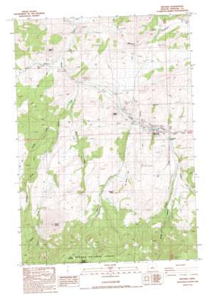
Mitchell Topo Map Oregon
To zoom in, hover over the map of Mitchell
USGS Topo Quad 44120e2 - 1:24,000 scale
| Topo Map Name: | Mitchell |
| USGS Topo Quad ID: | 44120e2 |
| Print Size: | ca. 21 1/4" wide x 27" high |
| Southeast Coordinates: | 44.5° N latitude / 120.125° W longitude |
| Map Center Coordinates: | 44.5625° N latitude / 120.1875° W longitude |
| U.S. State: | OR |
| Filename: | o44120e2.jpg |
| Download Map JPG Image: | Mitchell topo map 1:24,000 scale |
| Map Type: | Topographic |
| Topo Series: | 7.5´ |
| Map Scale: | 1:24,000 |
| Source of Map Images: | United States Geological Survey (USGS) |
| Alternate Map Versions: |
Mitchell OR 1988, updated 1988 Download PDF Buy paper map Mitchell OR 1992, updated 1997 Download PDF Buy paper map Mitchell OR 2011 Download PDF Buy paper map Mitchell OR 2014 Download PDF Buy paper map |
| FStopo: | US Forest Service topo Mitchell is available: Download FStopo PDF Download FStopo TIF |
1:24,000 Topo Quads surrounding Mitchell
> Back to 44120e1 at 1:100,000 scale
> Back to 44120a1 at 1:250,000 scale
> Back to U.S. Topo Maps home
Mitchell topo map: Gazetteer
Mitchell: Airports
Mitchell Airstrip elevation 894m 2933′Mitchell: Canals
Hall Ditch elevation 1045m 3428′Shoemaker Ditch elevation 1071m 3513′
Mitchell: Populated Places
Mitchell elevation 852m 2795′Mitchell: Post Offices
Mitchell Post Office elevation 852m 2795′Mitchell: Reservoirs
Dollarhide Pond elevation 887m 2910′Nelson Reservoir elevation 1604m 5262′
Paynes Pond elevation 875m 2870′
Mitchell: Streams
Gable Creek elevation 760m 2493′Johnson Creek elevation 932m 3057′
Keyes Creek elevation 868m 2847′
Mill Creek elevation 897m 2942′
Mud Creek elevation 729m 2391′
Nelson Creek elevation 807m 2647′
Thompson Creek elevation 914m 2998′
Weddle Creek elevation 784m 2572′
West Branch Bridge Creek elevation 698m 2290′
West Nelson Creek elevation 1035m 3395′
Mitchell: Summits
Bailey Butte elevation 1053m 3454′Juniper Butte elevation 1170m 3838′
Sargent Butte elevation 1006m 3300′
White Butte elevation 1724m 5656′
Mitchell: Valleys
Black Chunk Canyon elevation 1058m 3471′Five Minute Draw elevation 939m 3080′
Meyers Canyon elevation 679m 2227′
Mitchell digital topo map on disk
Buy this Mitchell topo map showing relief, roads, GPS coordinates and other geographical features, as a high-resolution digital map file on DVD:


