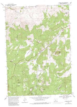
Lawson Mountain Topo Map Oregon
To zoom in, hover over the map of Lawson Mountain
USGS Topo Quad 44120e3 - 1:24,000 scale
| Topo Map Name: | Lawson Mountain |
| USGS Topo Quad ID: | 44120e3 |
| Print Size: | ca. 21 1/4" wide x 27" high |
| Southeast Coordinates: | 44.5° N latitude / 120.25° W longitude |
| Map Center Coordinates: | 44.5625° N latitude / 120.3125° W longitude |
| U.S. State: | OR |
| Filename: | o44120e3.jpg |
| Download Map JPG Image: | Lawson Mountain topo map 1:24,000 scale |
| Map Type: | Topographic |
| Topo Series: | 7.5´ |
| Map Scale: | 1:24,000 |
| Source of Map Images: | United States Geological Survey (USGS) |
| Alternate Map Versions: |
Lawson Mtn OR 1968, updated 1972 Download PDF Buy paper map Lawson Mtn OR 1968, updated 1985 Download PDF Buy paper map Lawson Mountain OR 1992, updated 1997 Download PDF Buy paper map Lawson Mountain OR 2011 Download PDF Buy paper map Lawson Mountain OR 2014 Download PDF Buy paper map |
| FStopo: | US Forest Service topo Lawson Mountain is available: Download FStopo PDF Download FStopo TIF |
1:24,000 Topo Quads surrounding Lawson Mountain
> Back to 44120e1 at 1:100,000 scale
> Back to 44120a1 at 1:250,000 scale
> Back to U.S. Topo Maps home
Lawson Mountain topo map: Gazetteer
Lawson Mountain: Canals
Lewis Ditch elevation 1110m 3641′Lawson Mountain: Flats
Blake Flat elevation 1106m 3628′Do Little Flat elevation 1105m 3625′
Hay Flat elevation 1084m 3556′
McNeese Flat elevation 1104m 3622′
Ross Flat elevation 1097m 3599′
Lawson Mountain: Post Offices
Liberty Post Office (historical) elevation 998m 3274′Lawson Mountain: Ranges
Gage Range elevation 830m 2723′Lawson Mountain: Ridges
Sheep Mountain elevation 1203m 3946′Specht Rim elevation 1281m 4202′
Lawson Mountain: Springs
Beaver Spring elevation 1219m 3999′Blake Spring elevation 1054m 3458′
Frier Spring elevation 1416m 4645′
Heflin Spring elevation 1383m 4537′
Sheep Smother Spring elevation 1492m 4895′
Lawson Mountain: Streams
Camp Creek elevation 1127m 3697′Carroll Creek elevation 933m 3061′
Clover Creek elevation 1483m 4865′
Gage Creek elevation 880m 2887′
O'Kelly Creek elevation 1094m 3589′
Rail Creek elevation 1071m 3513′
Slide Creek elevation 1106m 3628′
Stephenson Creek elevation 733m 2404′
Lawson Mountain: Summits
Bailey Butte elevation 1395m 4576′Black Butte elevation 1531m 5022′
Courthouse Rock elevation 1357m 4452′
Dove Mountain elevation 1393m 4570′
Gilchrist Butte elevation 1168m 3832′
Lawson Mountain elevation 1331m 4366′
Lewis Butte elevation 1379m 4524′
Richard Butte elevation 1429m 4688′
Sand Mountain elevation 1175m 3854′
Snowshoe Point elevation 1528m 5013′
Lawson Mountain: Valleys
Caesar Gulch elevation 781m 2562′Cougar Gulch elevation 901m 2956′
Post Gulch elevation 779m 2555′
Spring Gulch elevation 733m 2404′
Lawson Mountain digital topo map on disk
Buy this Lawson Mountain topo map showing relief, roads, GPS coordinates and other geographical features, as a high-resolution digital map file on DVD:


