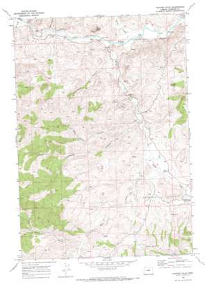
Painted Hills Topo Map Oregon
To zoom in, hover over the map of Painted Hills
USGS Topo Quad 44120f3 - 1:24,000 scale
| Topo Map Name: | Painted Hills |
| USGS Topo Quad ID: | 44120f3 |
| Print Size: | ca. 21 1/4" wide x 27" high |
| Southeast Coordinates: | 44.625° N latitude / 120.25° W longitude |
| Map Center Coordinates: | 44.6875° N latitude / 120.3125° W longitude |
| U.S. State: | OR |
| Filename: | o44120f3.jpg |
| Download Map JPG Image: | Painted Hills topo map 1:24,000 scale |
| Map Type: | Topographic |
| Topo Series: | 7.5´ |
| Map Scale: | 1:24,000 |
| Source of Map Images: | United States Geological Survey (USGS) |
| Alternate Map Versions: |
Painted Hills OR 1968, updated 1972 Download PDF Buy paper map Painted Hills OR 2011 Download PDF Buy paper map Painted Hills OR 2014 Download PDF Buy paper map |
1:24,000 Topo Quads surrounding Painted Hills
> Back to 44120e1 at 1:100,000 scale
> Back to 44120a1 at 1:250,000 scale
> Back to U.S. Topo Maps home
Painted Hills topo map: Gazetteer
Painted Hills: Dams
Painted Hills Dam elevation 570m 1870′Painted Hills: Parks
Painted Hills State Park (historical) elevation 594m 1948′Painted Hills: Post Offices
Bridge Creek Post Office (historical) elevation 535m 1755′Burnt Ranch Post Office (historical) elevation 454m 1489′
Seward Post Office (historical) elevation 573m 1879′
Painted Hills: Reservoirs
Painted Hills Reservoir elevation 570m 1870′Painted Hills: Ridges
Carroll Rim elevation 703m 2306′Painted Hills: Springs
Stovepipe Spring elevation 644m 2112′Painted Hills: Streams
Bear Creek elevation 557m 1827′Bridge Creek elevation 452m 1482′
Painted Hills: Summits
Byrds Point elevation 696m 2283′Painted Hills elevation 671m 2201′
Rainbow Hill elevation 675m 2214′
Red Scar Knoll elevation 700m 2296′
Painted Hills: Valleys
Brown Grotto elevation 597m 1958′Coyote Canyon elevation 503m 1650′
Dugout Canyon elevation 451m 1479′
John Day Gulch elevation 452m 1482′
Juniper Canyon elevation 439m 1440′
Lockwood Canyon elevation 545m 1788′
Pass Gulch elevation 685m 2247′
Pats Cabin Canyon elevation 615m 2017′
Shaw Canyon elevation 464m 1522′
Painted Hills digital topo map on disk
Buy this Painted Hills topo map showing relief, roads, GPS coordinates and other geographical features, as a high-resolution digital map file on DVD:


