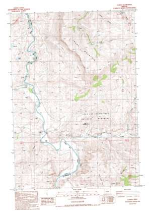
Clarno Topo Map Oregon
To zoom in, hover over the map of Clarno
USGS Topo Quad 44120h4 - 1:24,000 scale
| Topo Map Name: | Clarno |
| USGS Topo Quad ID: | 44120h4 |
| Print Size: | ca. 21 1/4" wide x 27" high |
| Southeast Coordinates: | 44.875° N latitude / 120.375° W longitude |
| Map Center Coordinates: | 44.9375° N latitude / 120.4375° W longitude |
| U.S. State: | OR |
| Filename: | o44120h4.jpg |
| Download Map JPG Image: | Clarno topo map 1:24,000 scale |
| Map Type: | Topographic |
| Topo Series: | 7.5´ |
| Map Scale: | 1:24,000 |
| Source of Map Images: | United States Geological Survey (USGS) |
| Alternate Map Versions: |
Clarno OR 1988, updated 1988 Download PDF Buy paper map Clarno OR 2011 Download PDF Buy paper map Clarno OR 2014 Download PDF Buy paper map |
1:24,000 Topo Quads surrounding Clarno
> Back to 44120e1 at 1:100,000 scale
> Back to 44120a1 at 1:250,000 scale
> Back to U.S. Topo Maps home
Clarno topo map: Gazetteer
Clarno: Arches
Claron Arch elevation 473m 1551′Clarno: Cliffs
The Palisades elevation 486m 1594′Clarno: Lakes
Rotten Lake elevation 469m 1538′Clarno: Populated Places
Clarno elevation 400m 1312′Clarno: Post Offices
Clarno Post Office (historical) elevation 400m 1312′Crown Rock Post Office (historical) elevation 430m 1410′
Francisville Post Office (historical) elevation 512m 1679′
Huntley Post Office (historical) elevation 400m 1312′
Clarno: Rapids
Clarno Rapids elevation 385m 1263′Clarno: Ridges
Black Spur elevation 549m 1801′Iron Mountain elevation 1198m 3930′
Clarno: Springs
Willow Branch Spring elevation 445m 1459′Clarno: Streams
Cove Creek elevation 481m 1578′Pine Creek elevation 400m 1312′
Sorefoot Creek elevation 391m 1282′
Willow Branch elevation 392m 1286′
Clarno: Summits
Horse Mountain elevation 857m 2811′Red Hill elevation 576m 1889′
Whitecap Knoll elevation 654m 2145′
Clarno: Valleys
Corral Canyon elevation 395m 1295′Equisetum Canyon elevation 493m 1617′
Hancock Canyon elevation 437m 1433′
Indian Canyon elevation 465m 1525′
Clarno digital topo map on disk
Buy this Clarno topo map showing relief, roads, GPS coordinates and other geographical features, as a high-resolution digital map file on DVD:


