Hastings Peak Topo Map Oregon
To zoom in, hover over the map of Hastings Peak
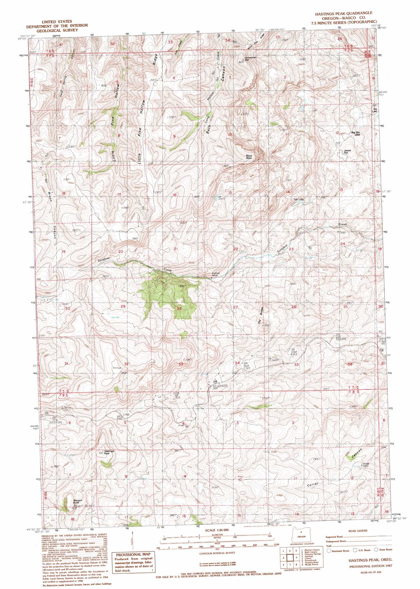
USGS Topo Quad 44120h5 - 1:24,000 scale
| Topo Map Name: | Hastings Peak |
| USGS Topo Quad ID: | 44120h5 |
| Print Size: | ca. 21 1/4" wide x 27" high |
| Southeast Coordinates: | 44.875° N latitude / 120.5° W longitude |
| Map Center Coordinates: | 44.9375° N latitude / 120.5625° W longitude |
| U.S. State: | OR |
| Filename: | o44120h5.jpg |
| Download Map JPG Image: | Hastings Peak topo map 1:24,000 scale |
| Map Type: | Topographic |
| Topo Series: | 7.5´ |
| Map Scale: | 1:24,000 |
| Source of Map Images: | United States Geological Survey (USGS) |
| Alternate Map Versions: |
Hastings Peak OR 1987, updated 1988 Download PDF Buy paper map Hastings Peak OR 2011 Download PDF Buy paper map Hastings Peak OR 2014 Download PDF Buy paper map |
1:24,000 Topo Quads surrounding Hastings Peak
Bronx Canyon |
Kent |
Horseshoe Bend |
Shoestring Ridge |
Schott Canyon |
Shaniko |
Macken Canyon |
Bath Canyon |
Chimney Springs |
Buckhorn Canyon |
Shaniko Summit |
Antelope |
Hastings Peak |
Clarno |
Porcupine Butte |
Degner Canyon |
Donnybrook |
Arrastra Butte |
Muddy Ranch |
Jennies Peak |
Ashwood |
Axehandle Butte |
Horse Heaven Creek |
Sandrock Mountain |
Painted Hills |
> Back to 44120e1 at 1:100,000 scale
> Back to 44120a1 at 1:250,000 scale
> Back to U.S. Topo Maps home
Hastings Peak topo map: Gazetteer
Hastings Peak: Flats
Big Dry Lake elevation 528m 1732′Jessie Flat elevation 592m 1942′
Hastings Peak: Lakes
Big Lake elevation 513m 1683′Tule Lake elevation 642m 2106′
Hastings Peak: Pillars
Black Rock elevation 1157m 3795′Hastings Peak: Summits
Chinaman Hat elevation 1093m 3585′Hastings Peak elevation 1290m 4232′
Maupin Butte elevation 1298m 4258′
The Buttes elevation 921m 3021′
Hastings Peak digital topo map on disk
Buy this Hastings Peak topo map showing relief, roads, GPS coordinates and other geographical features, as a high-resolution digital map file on DVD: