Antelope Topo Map Oregon
To zoom in, hover over the map of Antelope
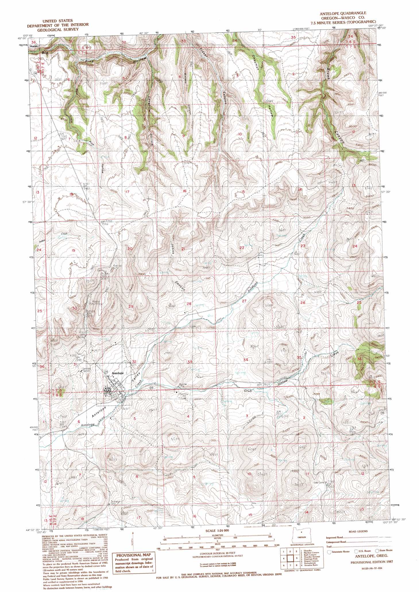
USGS Topo Quad 44120h6 - 1:24,000 scale
| Topo Map Name: | Antelope |
| USGS Topo Quad ID: | 44120h6 |
| Print Size: | ca. 21 1/4" wide x 27" high |
| Southeast Coordinates: | 44.875° N latitude / 120.625° W longitude |
| Map Center Coordinates: | 44.9375° N latitude / 120.6875° W longitude |
| U.S. State: | OR |
| Filename: | o44120h6.jpg |
| Download Map JPG Image: | Antelope topo map 1:24,000 scale |
| Map Type: | Topographic |
| Topo Series: | 7.5´ |
| Map Scale: | 1:24,000 |
| Source of Map Images: | United States Geological Survey (USGS) |
| Alternate Map Versions: |
Antelope OR 1987, updated 1988 Download PDF Buy paper map Antelope OR 2011 Download PDF Buy paper map Antelope OR 2014 Download PDF Buy paper map |
1:24,000 Topo Quads surrounding Antelope
Dead Dog Canyon |
Bronx Canyon |
Kent |
Horseshoe Bend |
Shoestring Ridge |
Criterion |
Shaniko |
Macken Canyon |
Bath Canyon |
Chimney Springs |
Shaniko Junction |
Shaniko Summit |
Antelope |
Hastings Peak |
Clarno |
Willowdale |
Degner Canyon |
Donnybrook |
Arrastra Butte |
Muddy Ranch |
Teller Butte |
Ashwood |
Axehandle Butte |
Horse Heaven Creek |
Sandrock Mountain |
> Back to 44120e1 at 1:100,000 scale
> Back to 44120a1 at 1:250,000 scale
> Back to U.S. Topo Maps home
Antelope topo map: Gazetteer
Antelope: Populated Places
Antelope elevation 809m 2654′Antelope: Post Offices
Antelope Post Office elevation 809m 2654′Antelope: Streams
Grub Hollow Creek elevation 795m 2608′Antelope: Valleys
Antelope Valley elevation 782m 2565′Johns Canyon elevation 855m 2805′
Laughlin Hollow elevation 873m 2864′
Wallace Canyon elevation 885m 2903′
West Little Pine Hollow elevation 895m 2936′
Antelope digital topo map on disk
Buy this Antelope topo map showing relief, roads, GPS coordinates and other geographical features, as a high-resolution digital map file on DVD: