Opal City Topo Map Oregon
To zoom in, hover over the map of Opal City
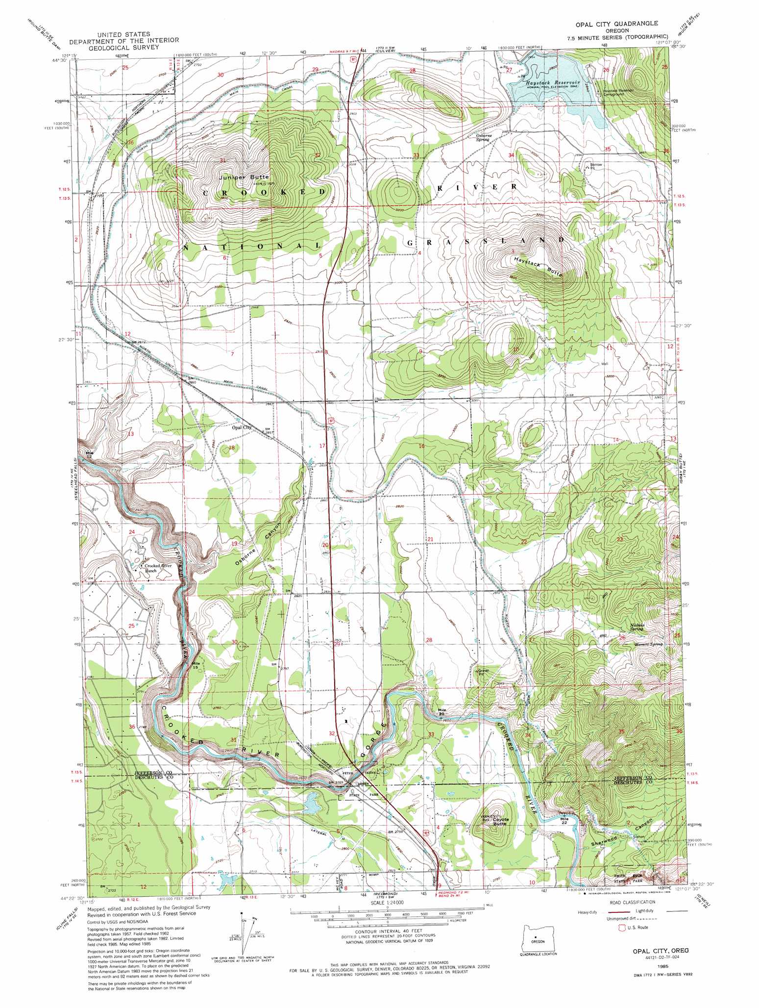
USGS Topo Quad 44121d2 - 1:24,000 scale
| Topo Map Name: | Opal City |
| USGS Topo Quad ID: | 44121d2 |
| Print Size: | ca. 21 1/4" wide x 27" high |
| Southeast Coordinates: | 44.375° N latitude / 121.125° W longitude |
| Map Center Coordinates: | 44.4375° N latitude / 121.1875° W longitude |
| U.S. State: | OR |
| Filename: | o44121d2.jpg |
| Download Map JPG Image: | Opal City topo map 1:24,000 scale |
| Map Type: | Topographic |
| Topo Series: | 7.5´ |
| Map Scale: | 1:24,000 |
| Source of Map Images: | United States Geological Survey (USGS) |
| Alternate Map Versions: |
Opal City OR 1962, updated 1963 Download PDF Buy paper map Opal City OR 1962, updated 1972 Download PDF Buy paper map Opal City OR 1985, updated 1986 Download PDF Buy paper map Opal City OR 1992, updated 1997 Download PDF Buy paper map Opal City OR 2011 Download PDF Buy paper map Opal City OR 2014 Download PDF Buy paper map |
| FStopo: | US Forest Service topo Opal City is available: Download FStopo PDF Download FStopo TIF |
1:24,000 Topo Quads surrounding Opal City
Metolius Bench |
Seekseequa Junction |
Madras West |
Madras East |
Teller Butte |
Fly Creek |
Round Butte Dam |
Culver |
Buck Butte |
Brewer Reservoir |
Squaw Back Ridge |
Steelhead Falls |
Opal City |
Gray Butte |
Grizzly Mountain |
Henkle Butte |
Cline Falls |
Redmond |
O'Neil |
Houston Lake |
Tumalo Dam |
Tumalo |
Forked Horn Butte |
Powell Butte |
Powell Buttes |
> Back to 44121a1 at 1:100,000 scale
> Back to 44120a1 at 1:250,000 scale
> Back to U.S. Topo Maps home
Opal City topo map: Gazetteer
Opal City: Dams
Haystack Dam elevation 867m 2844′Opal City: Parks
Peter Skene Ogden State Park elevation 813m 2667′Opal City: Populated Places
Crooked River Ranch elevation 793m 2601′Opal City elevation 872m 2860′
Opal City: Post Offices
Crooked River Ranch Post Office elevation 793m 2601′Haystack Post Office (historical) elevation 867m 2844′
Opal City Post Office (historical) elevation 872m 2860′
Opal City: Reservoirs
Haystack Reservoir elevation 867m 2844′Opal City: Springs
East Springer Spring elevation 921m 3021′Meralle Spring elevation 1049m 3441′
Nichols Spring elevation 988m 3241′
Osborne Spring elevation 896m 2939′
Opal City: Summits
Coyote Butte elevation 953m 3126′Haystack Butte elevation 1226m 4022′
Juniper Butte elevation 1192m 3910′
Opal City: Valleys
Osborne Canyon elevation 701m 2299′Sherwood Canyon elevation 827m 2713′
Opal City digital topo map on disk
Buy this Opal City topo map showing relief, roads, GPS coordinates and other geographical features, as a high-resolution digital map file on DVD: