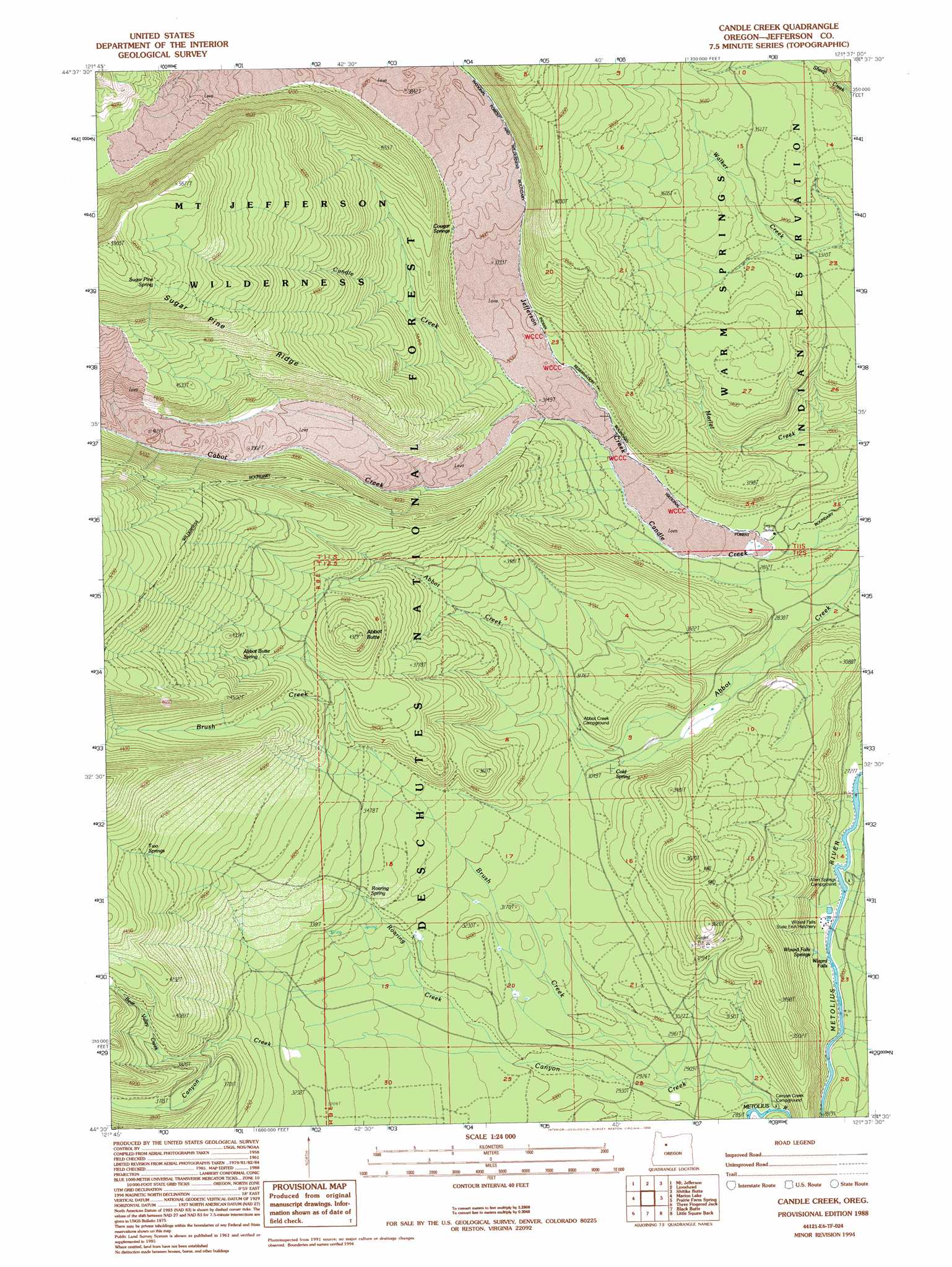
Candle Creek Topo Map Oregon
To zoom in, hover over the map of Candle Creek
USGS Topo Quad 44121e6 - 1:24,000 scale
| Topo Map Name: | Candle Creek |
| USGS Topo Quad ID: | 44121e6 |
| Print Size: | ca. 21 1/4" wide x 27" high |
| Southeast Coordinates: | 44.5° N latitude / 121.625° W longitude |
| Map Center Coordinates: | 44.5625° N latitude / 121.6875° W longitude |
| U.S. State: | OR |
| Filename: | o44121e6.jpg |
| Download Map JPG Image: | Candle Creek topo map 1:24,000 scale |
| Map Type: | Topographic |
| Topo Series: | 7.5´ |
| Map Scale: | 1:24,000 |
| Source of Map Images: | United States Geological Survey (USGS) |
| Alternate Map Versions: |
Candle Creek OR 1988, updated 1988 Download PDF Buy paper map Candle Creek OR 1988, updated 1994 Download PDF Buy paper map Candle Creek OR 2011 Download PDF Buy paper map Candle Creek OR 2014 Download PDF Buy paper map |
| FStopo: | US Forest Service topo Candle Creek is available: Download FStopo PDF Download FStopo TIF |
1:24,000 Topo Quads surrounding Candle Creek
Breitenbush Hot Spring |
Olallie Butte |
Boulder Lake |
Sawmill Butte |
Potters Ponds |
Mount Bruno |
Mount Jefferson |
Lionshead |
Shitike Butte |
Metolius Bench |
Marion Forks |
Marion Lake |
Candle Creek |
Prairie Farm Spring |
Fly Creek |
Santiam Junction |
Three Fingered Jack |
Black Butte |
Little Squaw Back |
Squaw Back Ridge |
Clear Lake |
Mount Washington |
Black Crater |
Sisters |
Henkle Butte |
> Back to 44121e1 at 1:100,000 scale
> Back to 44120a1 at 1:250,000 scale
> Back to U.S. Topo Maps home
Candle Creek topo map: Gazetteer
Candle Creek: Falls
Wizard Falls elevation 844m 2769′Candle Creek: Ridges
Sugar Pine Ridge elevation 1494m 4901′Candle Creek: Springs
Abbot Butte Spring elevation 1249m 4097′Cold Spring elevation 927m 3041′
Cougar Spring elevation 1051m 3448′
Roaring Spring elevation 1011m 3316′
Sugarpine Spring elevation 1698m 5570′
Two Springs elevation 1262m 4140′
Wizzard Falls Spring elevation 845m 2772′
Candle Creek: Streams
Bear Valley Creek elevation 1056m 3464′Brush Creek elevation 883m 2896′
Cabot Creek elevation 951m 3120′
Canyon Creek elevation 877m 2877′
Roaring Creek elevation 919m 3015′
Candle Creek: Summits
Abbot Butte elevation 1321m 4333′Candle Creek: Trails
Cabot Lake Trail elevation 1404m 4606′Jefferson Lake Trail elevation 1272m 4173′
Sugar Pine Ridge Trail elevation 1773m 5816′
Candle Creek digital topo map on disk
Buy this Candle Creek topo map showing relief, roads, GPS coordinates and other geographical features, as a high-resolution digital map file on DVD: