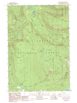
Marion Forks Topo Map Oregon
To zoom in, hover over the map of Marion Forks
USGS Topo Quad 44121e8 - 1:24,000 scale
| Topo Map Name: | Marion Forks |
| USGS Topo Quad ID: | 44121e8 |
| Print Size: | ca. 21 1/4" wide x 27" high |
| Southeast Coordinates: | 44.5° N latitude / 121.875° W longitude |
| Map Center Coordinates: | 44.5625° N latitude / 121.9375° W longitude |
| U.S. State: | OR |
| Filename: | o44121e8.jpg |
| Download Map JPG Image: | Marion Forks topo map 1:24,000 scale |
| Map Type: | Topographic |
| Topo Series: | 7.5´ |
| Map Scale: | 1:24,000 |
| Source of Map Images: | United States Geological Survey (USGS) |
| Alternate Map Versions: |
Marion Forks OR 1988, updated 1988 Download PDF Buy paper map Marion Forks OR 1988, updated 1994 Download PDF Buy paper map Marion Forks OR 1994, updated 1998 Download PDF Buy paper map Marion Forks OR 2011 Download PDF Buy paper map Marion Forks OR 2014 Download PDF Buy paper map |
| FStopo: | US Forest Service topo Marion Forks is available: Download FStopo PDF Download FStopo TIF |
1:24,000 Topo Quads surrounding Marion Forks
> Back to 44121e1 at 1:100,000 scale
> Back to 44120a1 at 1:250,000 scale
> Back to U.S. Topo Maps home
Marion Forks topo map: Gazetteer
Marion Forks: Falls
Gatch Falls elevation 1220m 4002′Gooch Falls elevation 925m 3034′
Marion Falls elevation 1191m 3907′
Marion Forks: Flats
Marion Flats elevation 1357m 4452′Marion Forks: Lakes
Cleo Lake elevation 1398m 4586′Davis Lake elevation 1401m 4596′
Fay Lake elevation 1168m 3832′
Fir Lake elevation 1229m 4032′
Green Peak Lake elevation 1705m 5593′
Grenet Lake elevation 1582m 5190′
Lula Lake elevation 1582m 5190′
Maude Lake elevation 1508m 4947′
Monty Lake elevation 1450m 4757′
Mowich Lake elevation 1549m 5082′
Nan-Scott Lake elevation 756m 2480′
O A Lake elevation 1346m 4416′
Pika Lake elevation 1206m 3956′
Pine Ridge Lake elevation 1382m 4534′
Pinet Lake elevation 1327m 4353′
Presley Lake elevation 1069m 3507′
Temple Lake elevation 1352m 4435′
Turpentine Lake elevation 1434m 4704′
Widgeon Lake elevation 1327m 4353′
Marion Forks: Pillars
Independence Rock elevation 869m 2851′Marion Forks: Populated Places
Marion Forks elevation 746m 2447′Marion Forks: Ridges
Bingham Ridge elevation 1578m 5177′Pine Ridge elevation 1222m 4009′
Marion Forks: Streams
Bruno Creek elevation 732m 2401′Bugaboo Creek elevation 780m 2559′
Camp Creek elevation 961m 3152′
Downing Creek elevation 827m 2713′
Green Creek elevation 1307m 4288′
Horn Creek elevation 748m 2454′
Marion Creek elevation 743m 2437′
Moon Creek elevation 856m 2808′
Nan Creek elevation 889m 2916′
Parkett Creek elevation 811m 2660′
Puzzle Creek elevation 847m 2778′
Straight Creek elevation 848m 2782′
Turpentine Creek elevation 975m 3198′
Willis Creek elevation 779m 2555′
Marion Forks: Summits
Green Peak elevation 1856m 6089′Marion Mountain elevation 1604m 5262′
Marion Peak elevation 1860m 6102′
Saddle Mountain elevation 1879m 6164′
Turpentine Peak elevation 1760m 5774′
Marion Forks: Swamps
Big Meadows elevation 1106m 3628′Twin Meadows elevation 1142m 3746′
Marion Forks: Trails
Marion Lake Trail elevation 1045m 3428′Pine Ridge Trail elevation 1477m 4845′
Turpentine Peak Trail elevation 1563m 5127′
Marion Forks digital topo map on disk
Buy this Marion Forks topo map showing relief, roads, GPS coordinates and other geographical features, as a high-resolution digital map file on DVD:


