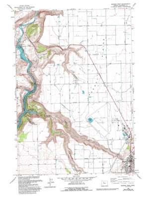
Madras West Topo Map Oregon
To zoom in, hover over the map of Madras West
USGS Topo Quad 44121f2 - 1:24,000 scale
| Topo Map Name: | Madras West |
| USGS Topo Quad ID: | 44121f2 |
| Print Size: | ca. 21 1/4" wide x 27" high |
| Southeast Coordinates: | 44.625° N latitude / 121.125° W longitude |
| Map Center Coordinates: | 44.6875° N latitude / 121.1875° W longitude |
| U.S. State: | OR |
| Filename: | o44121f2.jpg |
| Download Map JPG Image: | Madras West topo map 1:24,000 scale |
| Map Type: | Topographic |
| Topo Series: | 7.5´ |
| Map Scale: | 1:24,000 |
| Source of Map Images: | United States Geological Survey (USGS) |
| Alternate Map Versions: |
Madras West OR 1963, updated 1964 Download PDF Buy paper map Madras West OR 1963, updated 1983 Download PDF Buy paper map Madras West OR 1963, updated 1994 Download PDF Buy paper map Madras West OR 1985, updated 1986 Download PDF Buy paper map Madras West OR 1992, updated 1997 Download PDF Buy paper map Madras West OR 2011 Download PDF Buy paper map Madras West OR 2014 Download PDF Buy paper map |
| FStopo: | US Forest Service topo Madras West is available: Download FStopo PDF Download FStopo TIF |
1:24,000 Topo Quads surrounding Madras West
> Back to 44121e1 at 1:100,000 scale
> Back to 44120a1 at 1:250,000 scale
> Back to U.S. Topo Maps home
Madras West topo map: Gazetteer
Madras West: Airports
City-County Airport elevation 744m 2440′Madras West: Dams
Jefferson Plywood Company Dam elevation 749m 2457′Pelton Dam elevation 468m 1535′
Pelton Regulating Dam elevation 428m 1404′
Madras West: Flats
Agency Plains elevation 733m 2404′Little Agency Plains elevation 755m 2477′
Madras West: Parks
7th Street Park elevation 685m 2247′Community Park elevation 684m 2244′
Friendship Park elevation 688m 2257′
Pelton Park elevation 497m 1630′
Totem Park elevation 703m 2306′
Madras West: Populated Places
Madras elevation 683m 2240′Madras West: Post Offices
Air Base Post Office (historical) elevation 744m 2440′Madras Post Office elevation 683m 2240′
Vanora Post Office (historical) elevation 479m 1571′
Madras West: Reservoirs
Jefferson Plywood Company Mill Pond elevation 749m 2457′Lake Simtustus elevation 483m 1584′
Pelton Regulating Reservoir elevation 428m 1404′
U P Water Tank (historical) elevation 750m 2460′
Madras West: Streams
Campbell Creek elevation 439m 1440′Seekseequa Creek elevation 483m 1584′
Willow Creek elevation 485m 1591′
Madras West: Valleys
Dry Canyon elevation 485m 1591′Dry Hollow elevation 483m 1584′
Hurbers Canyon elevation 491m 1610′
Negro Brown Canyon elevation 438m 1437′
Willow Creek Canyon elevation 487m 1597′
Madras West digital topo map on disk
Buy this Madras West topo map showing relief, roads, GPS coordinates and other geographical features, as a high-resolution digital map file on DVD:


