Sawmill Butte Topo Map Oregon
To zoom in, hover over the map of Sawmill Butte
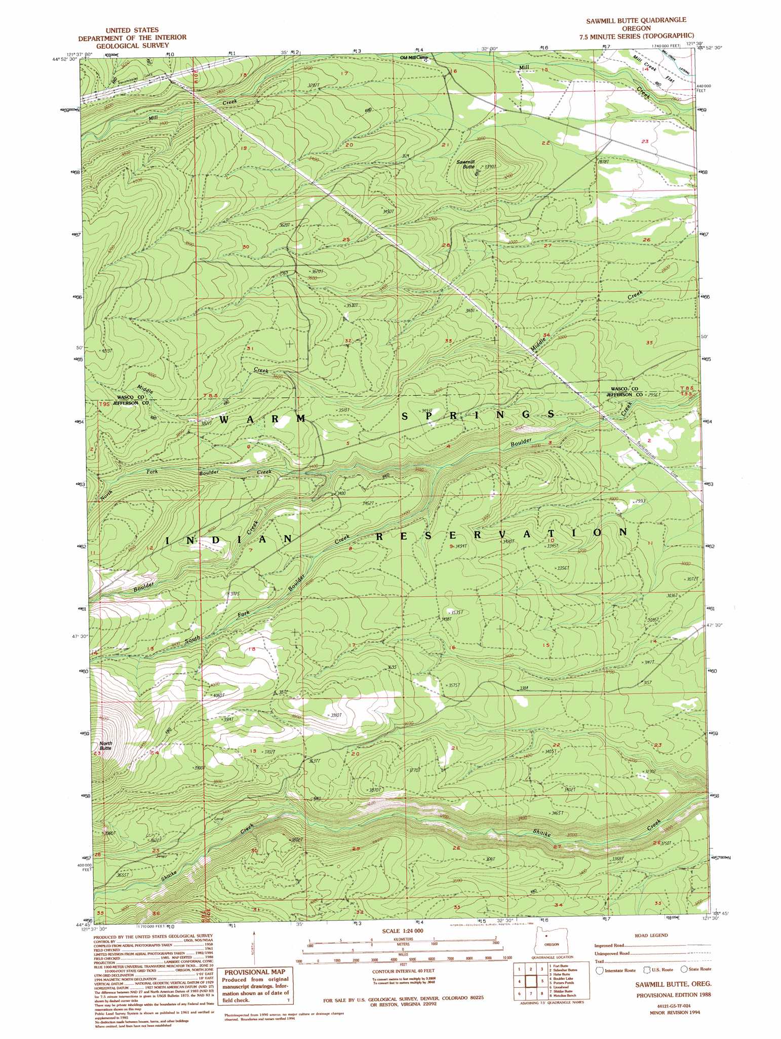
USGS Topo Quad 44121g5 - 1:24,000 scale
| Topo Map Name: | Sawmill Butte |
| USGS Topo Quad ID: | 44121g5 |
| Print Size: | ca. 21 1/4" wide x 27" high |
| Southeast Coordinates: | 44.75° N latitude / 121.5° W longitude |
| Map Center Coordinates: | 44.8125° N latitude / 121.5625° W longitude |
| U.S. State: | OR |
| Filename: | o44121g5.jpg |
| Download Map JPG Image: | Sawmill Butte topo map 1:24,000 scale |
| Map Type: | Topographic |
| Topo Series: | 7.5´ |
| Map Scale: | 1:24,000 |
| Source of Map Images: | United States Geological Survey (USGS) |
| Alternate Map Versions: |
Sawmill Butte OR 1988, updated 1988 Download PDF Buy paper map Sawmill Butte OR 1988, updated 1994 Download PDF Buy paper map Sawmill Butte OR 2011 Download PDF Buy paper map Sawmill Butte OR 2014 Download PDF Buy paper map |
1:24,000 Topo Quads surrounding Sawmill Butte
Timothy Lake |
Mount Wilson |
Beaver Butte |
Foreman Point |
Wapinitia |
Pinhead Buttes |
Fort Butte |
Sidwalter Buttes |
Hehe Butte |
Simnasho |
Olallie Butte |
Boulder Lake |
Sawmill Butte |
Potters Ponds |
Warm Springs |
Mount Jefferson |
Lionshead |
Shitike Butte |
Metolius Bench |
Seekseequa Junction |
Marion Lake |
Candle Creek |
Prairie Farm Spring |
Fly Creek |
Round Butte Dam |
> Back to 44121e1 at 1:100,000 scale
> Back to 44120a1 at 1:250,000 scale
> Back to U.S. Topo Maps home
Sawmill Butte topo map: Gazetteer
Sawmill Butte: Canals
Mill Creek Lateral elevation 865m 2837′Sawmill Butte: Streams
North Fork Boulder Creek elevation 987m 3238′South Fork Boulder Creek elevation 923m 3028′
Sawmill Butte: Summits
Sawmill Butte elevation 1029m 3375′Sawmill Butte digital topo map on disk
Buy this Sawmill Butte topo map showing relief, roads, GPS coordinates and other geographical features, as a high-resolution digital map file on DVD: