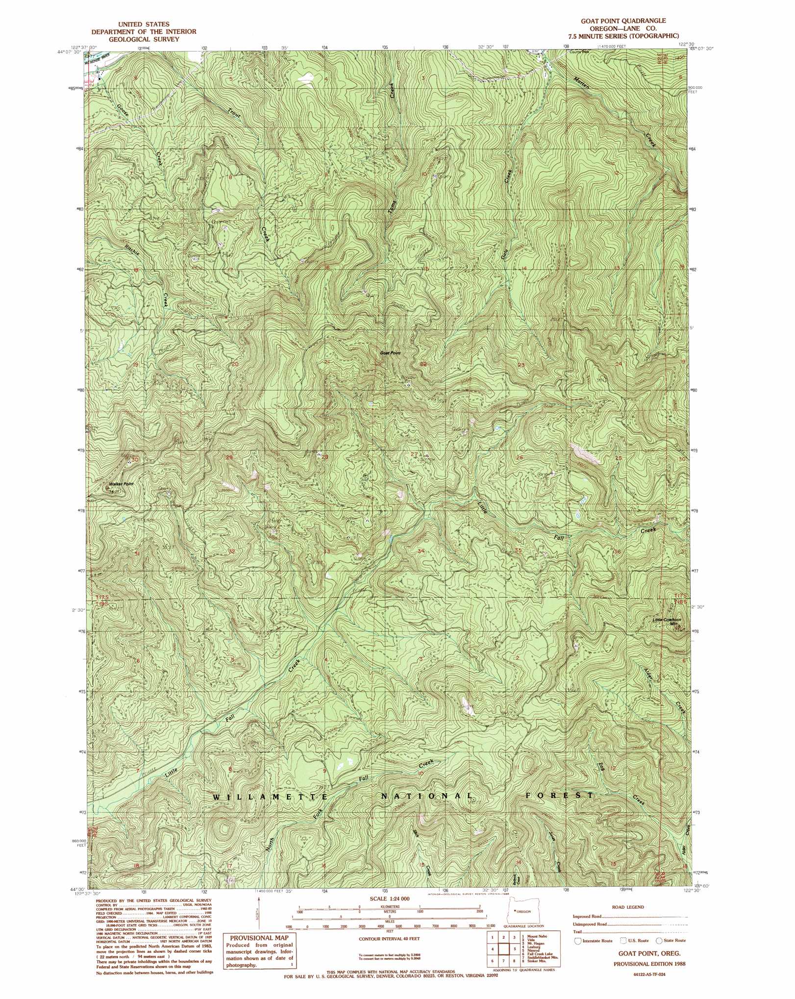
Goat Mountain Topo Map Oregon
To zoom in, hover over the map of Goat Mountain
USGS Topo Quad 44122a5 - 1:24,000 scale
| Topo Map Name: | Goat Mountain |
| USGS Topo Quad ID: | 44122a5 |
| Print Size: | ca. 21 1/4" wide x 27" high |
| Southeast Coordinates: | 44° N latitude / 122.5° W longitude |
| Map Center Coordinates: | 44.0625° N latitude / 122.5625° W longitude |
| U.S. State: | OR |
| Filename: | o44122a5.jpg |
| Download Map JPG Image: | Goat Mountain topo map 1:24,000 scale |
| Map Type: | Topographic |
| Topo Series: | 7.5´ |
| Map Scale: | 1:24,000 |
| Source of Map Images: | United States Geological Survey (USGS) |
| Alternate Map Versions: |
Goat Point OR 1988, updated 1988 Download PDF Buy paper map Goat Point OR 1997, updated 2001 Download PDF Buy paper map Goat Point OR 2011 Download PDF Buy paper map Goat Point OR 2014 Download PDF Buy paper map |
| FStopo: | US Forest Service topo Goat Point is available: Download FStopo PDF Download FStopo TIF |
1:24,000 Topo Quads surrounding Goat Mountain
Crawfordsville |
Chandler Mountain |
Farmers Butte |
Swamp Mountain |
Tidbits Mountain |
Marcola |
Mount Nebo |
Vida |
Mount Hagan |
Blue River |
Walterville |
Leaburg |
Goat Mountain |
Nimrod |
Harvey Mountain |
Lowell |
Fall Creek Lake |
Saddleblanket Mountain |
Sinker Mountain |
Sardine Butte |
Kloster Mountain |
Mount June |
Westfir West |
Westfir East |
Huckleberry Mountain |
> Back to 44122a1 at 1:100,000 scale
> Back to 44122a1 at 1:250,000 scale
> Back to U.S. Topo Maps home
Goat Mountain topo map: Gazetteer
Goat Mountain: Streams
Brook Creek elevation 410m 1345′Gale Creek elevation 255m 836′
Goose Creek elevation 453m 1486′
Miller Creek elevation 315m 1033′
Zog Creek elevation 451m 1479′
Goat Mountain: Summits
Goat Point elevation 1163m 3815′Little Cowhorn Mountain elevation 1272m 4173′
Walker Point elevation 1148m 3766′
Goat Mountain: Trails
Cowhorn Trail elevation 893m 2929′Goat Mountain digital topo map on disk
Buy this Goat Mountain topo map showing relief, roads, GPS coordinates and other geographical features, as a high-resolution digital map file on DVD: