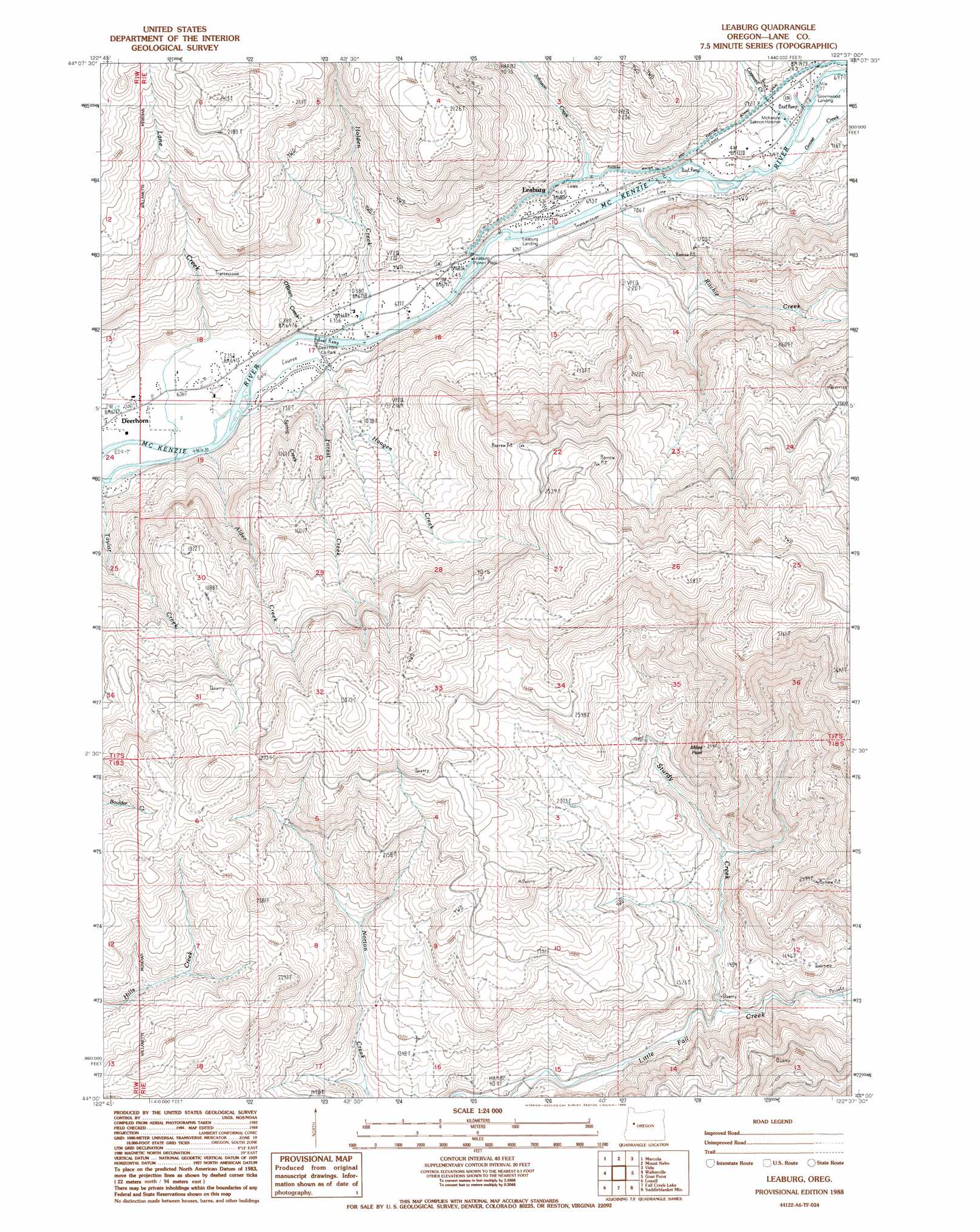
Leaburg Topo Map Oregon
To zoom in, hover over the map of Leaburg
USGS Topo Quad 44122a6 - 1:24,000 scale
| Topo Map Name: | Leaburg |
| USGS Topo Quad ID: | 44122a6 |
| Print Size: | ca. 21 1/4" wide x 27" high |
| Southeast Coordinates: | 44° N latitude / 122.625° W longitude |
| Map Center Coordinates: | 44.0625° N latitude / 122.6875° W longitude |
| U.S. State: | OR |
| Filename: | o44122a6.jpg |
| Download Map JPG Image: | Leaburg topo map 1:24,000 scale |
| Map Type: | Topographic |
| Topo Series: | 7.5´ |
| Map Scale: | 1:24,000 |
| Source of Map Images: | United States Geological Survey (USGS) |
| Alternate Map Versions: |
Leaburg OR 1988, updated 1988 Download PDF Buy paper map Leaburg OR 2011 Download PDF Buy paper map Leaburg OR 2014 Download PDF Buy paper map |
1:24,000 Topo Quads surrounding Leaburg
Union Point |
Crawfordsville |
Chandler Mountain |
Farmers Butte |
Swamp Mountain |
Mohawk |
Marcola |
Mount Nebo |
Vida |
Mount Hagan |
Springfield |
Walterville |
Leaburg |
Goat Mountain |
Nimrod |
Jasper |
Lowell |
Fall Creek Lake |
Saddleblanket Mountain |
Sinker Mountain |
Dorena Lake |
Kloster Mountain |
Mount June |
Westfir West |
Westfir East |
> Back to 44122a1 at 1:100,000 scale
> Back to 44122a1 at 1:250,000 scale
> Back to U.S. Topo Maps home
Leaburg topo map: Gazetteer
Leaburg: Canals
Eugene Water and Electric Board Canal elevation 224m 734′Leaburg: Parks
Deerhorn County Park elevation 198m 649′Greenwood Landing County Park elevation 214m 702′
Leaburg Landing County Park elevation 200m 656′
Leaburg: Populated Places
Deerhorn elevation 192m 629′Leaburg elevation 207m 679′
Leaburg: Post Offices
Deerhorn Post Office (historical) elevation 192m 629′Leaburg Post Office elevation 207m 679′
Leaburg: Streams
Alder Creek elevation 193m 633′Cogswell Creek elevation 214m 702′
Forest Creek elevation 198m 649′
Haagen Creek elevation 192m 629′
Holden Creek elevation 197m 646′
Johnson Creek elevation 231m 757′
Lane Creek elevation 190m 623′
Montgomery Creek elevation 234m 767′
O'Brien Creek elevation 202m 662′
Ritchie Creek elevation 205m 672′
Spring Creek elevation 205m 672′
Sturdy Creek elevation 348m 1141′
Wallace Creek elevation 259m 849′
Ward Creek elevation 226m 741′
Leaburg: Summits
Miles Peak elevation 896m 2939′Leaburg digital topo map on disk
Buy this Leaburg topo map showing relief, roads, GPS coordinates and other geographical features, as a high-resolution digital map file on DVD: