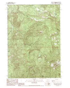
Tidbits Mountain Topo Map Oregon
To zoom in, hover over the map of Tidbits Mountain
USGS Topo Quad 44122c3 - 1:24,000 scale
| Topo Map Name: | Tidbits Mountain |
| USGS Topo Quad ID: | 44122c3 |
| Print Size: | ca. 21 1/4" wide x 27" high |
| Southeast Coordinates: | 44.25° N latitude / 122.25° W longitude |
| Map Center Coordinates: | 44.3125° N latitude / 122.3125° W longitude |
| U.S. State: | OR |
| Filename: | o44122c3.jpg |
| Download Map JPG Image: | Tidbits Mountain topo map 1:24,000 scale |
| Map Type: | Topographic |
| Topo Series: | 7.5´ |
| Map Scale: | 1:24,000 |
| Source of Map Images: | United States Geological Survey (USGS) |
| Alternate Map Versions: |
Tidbits Mountain OR 1989, updated 1989 Download PDF Buy paper map Tidbits Mountain OR 1994, updated 1998 Download PDF Buy paper map Tidbits Mountain OR 2011 Download PDF Buy paper map Tidbits Mountain OR 2014 Download PDF Buy paper map |
| FStopo: | US Forest Service topo Tidbits Mountain is available: Download FStopo PDF Download FStopo TIF |
1:24,000 Topo Quads surrounding Tidbits Mountain
> Back to 44122a1 at 1:100,000 scale
> Back to 44122a1 at 1:250,000 scale
> Back to U.S. Topo Maps home
Tidbits Mountain topo map: Gazetteer
Tidbits Mountain: Flats
Gordon Meadows elevation 1276m 4186′Tidbits Mountain: Gaps
Bear Pass elevation 1318m 4324′Tidbits Mountain: Lakes
Gordon Lakes elevation 1162m 3812′Lost Lake elevation 1136m 3727′
Tidbits Mountain: Pillars
Pipe Rock elevation 884m 2900′Tidbits Mountain: Ridges
Owl Ridge elevation 1096m 3595′Tidbits Mountain: Streams
Boundary Creek elevation 513m 1683′Coley Creek elevation 545m 1788′
Cul de Sac Creek elevation 654m 2145′
Elbow Creek elevation 706m 2316′
Loon Creek elevation 605m 1984′
Moe Creek elevation 745m 2444′
Owl Creek elevation 496m 1627′
Seventeen Creek elevation 767m 2516′
Two Girls Creek elevation 552m 1811′
Wet Horse Creek elevation 627m 2057′
Tidbits Mountain: Summits
Soapgrass Mountain elevation 1577m 5173′Tidbits Mountain elevation 1560m 5118′
Twin Buttes elevation 1507m 4944′
Two Girls elevation 1413m 4635′
Tidbits Mountain: Trails
Gold Hill Trail (historical) elevation 1304m 4278′Tidbits Mountain digital topo map on disk
Buy this Tidbits Mountain topo map showing relief, roads, GPS coordinates and other geographical features, as a high-resolution digital map file on DVD:


