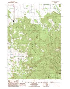
Union Point Topo Map Oregon
To zoom in, hover over the map of Union Point
USGS Topo Quad 44122c8 - 1:24,000 scale
| Topo Map Name: | Union Point |
| USGS Topo Quad ID: | 44122c8 |
| Print Size: | ca. 21 1/4" wide x 27" high |
| Southeast Coordinates: | 44.25° N latitude / 122.875° W longitude |
| Map Center Coordinates: | 44.3125° N latitude / 122.9375° W longitude |
| U.S. State: | OR |
| Filename: | o44122c8.jpg |
| Download Map JPG Image: | Union Point topo map 1:24,000 scale |
| Map Type: | Topographic |
| Topo Series: | 7.5´ |
| Map Scale: | 1:24,000 |
| Source of Map Images: | United States Geological Survey (USGS) |
| Alternate Map Versions: |
Union Point OR 1988, updated 1988 Download PDF Buy paper map Union Point OR 2011 Download PDF Buy paper map Union Point OR 2014 Download PDF Buy paper map |
1:24,000 Topo Quads surrounding Union Point
> Back to 44122a1 at 1:100,000 scale
> Back to 44122a1 at 1:250,000 scale
> Back to U.S. Topo Maps home
Union Point topo map: Gazetteer
Union Point: Bridges
McKercher Bridge elevation 132m 433′Union Point: Parks
McKercher County Park elevation 279m 915′Union Point: Pillars
Horse Rock elevation 860m 2821′Union Point: Populated Places
Union Point (historical) elevation 116m 380′Union Point: Post Offices
Diamond Hill Post Office (historical) elevation 146m 479′Union Point Post Office (historical) elevation 116m 380′
Union Point: Ridges
Cougar Ridge elevation 566m 1856′Union Point: Streams
Owl Creek elevation 294m 964′Union Point: Summits
Bald Mountain elevation 861m 2824′Diamond Hill elevation 177m 580′
Union Point digital topo map on disk
Buy this Union Point topo map showing relief, roads, GPS coordinates and other geographical features, as a high-resolution digital map file on DVD:


