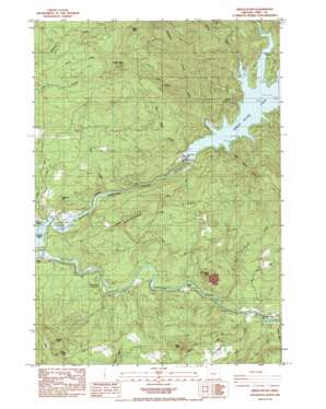
Green Peter Topo Map Oregon
To zoom in, hover over the map of Green Peter
USGS Topo Quad 44122d5 - 1:24,000 scale
| Topo Map Name: | Green Peter |
| USGS Topo Quad ID: | 44122d5 |
| Print Size: | ca. 21 1/4" wide x 27" high |
| Southeast Coordinates: | 44.375° N latitude / 122.5° W longitude |
| Map Center Coordinates: | 44.4375° N latitude / 122.5625° W longitude |
| U.S. State: | OR |
| Filename: | o44122d5.jpg |
| Download Map JPG Image: | Green Peter topo map 1:24,000 scale |
| Map Type: | Topographic |
| Topo Series: | 7.5´ |
| Map Scale: | 1:24,000 |
| Source of Map Images: | United States Geological Survey (USGS) |
| Alternate Map Versions: |
Green Peter OR 1984, updated 1985 Download PDF Buy paper map Green Peter OR 2011 Download PDF Buy paper map Green Peter OR 2014 Download PDF Buy paper map |
1:24,000 Topo Quads surrounding Green Peter
> Back to 44122a1 at 1:100,000 scale
> Back to 44122a1 at 1:250,000 scale
> Back to U.S. Topo Maps home
Green Peter topo map: Gazetteer
Green Peter: Bridges
Hufford Bridge elevation 197m 646′Short Bridge elevation 238m 780′
Green Peter: Dams
Green Peter Dam elevation 309m 1013′Green Peter: Flats
Dundon Flat elevation 233m 764′Green Peter: Parks
Calkins Park elevation 208m 682′Lewis Creek County Park elevation 195m 639′
River Bend County Park elevation 222m 728′
Sunnyside County Park elevation 199m 652′
Thistle Creek County Park elevation 526m 1725′
Whitcomb Creek County Park elevation 326m 1069′
Green Peter: Post Offices
Mealey Post Office (historical) elevation 695m 2280′Green Peter: Reservoirs
Green Peter Lake elevation 309m 1013′Green Peter: Springs
Whisky Springs elevation 479m 1571′Green Peter: Streams
Big Alder Creek elevation 321m 1053′Coal Creek elevation 203m 666′
Deadman Creek elevation 344m 1128′
Deer Creek elevation 232m 761′
Green Peter Creek elevation 309m 1013′
Hughes Creek elevation 195m 639′
Little Bottom Creek elevation 309m 1013′
Mouse Creek elevation 248m 813′
Quartzville Creek elevation 309m 1013′
Rumbaugh Creek elevation 309m 1013′
Shot Pouch Creek elevation 239m 784′
South Fork McDowell Creek elevation 621m 2037′
Thistle Creek elevation 309m 1013′
Whitcomb Creek elevation 309m 1013′
Green Peter: Summits
Bald Peter elevation 1205m 3953′Green Peter elevation 1149m 3769′
Greenhorn Hill elevation 402m 1318′
Moss Butte elevation 769m 2522′
Shot Pouch Butte elevation 573m 1879′
Whisky Butte elevation 616m 2020′
Green Peter digital topo map on disk
Buy this Green Peter topo map showing relief, roads, GPS coordinates and other geographical features, as a high-resolution digital map file on DVD:


