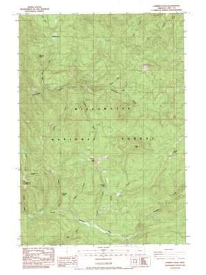
Chimney Peak Topo Map Oregon
To zoom in, hover over the map of Chimney Peak
USGS Topo Quad 44122e2 - 1:24,000 scale
| Topo Map Name: | Chimney Peak |
| USGS Topo Quad ID: | 44122e2 |
| Print Size: | ca. 21 1/4" wide x 27" high |
| Southeast Coordinates: | 44.5° N latitude / 122.125° W longitude |
| Map Center Coordinates: | 44.5625° N latitude / 122.1875° W longitude |
| U.S. State: | OR |
| Filename: | o44122e2.jpg |
| Download Map JPG Image: | Chimney Peak topo map 1:24,000 scale |
| Map Type: | Topographic |
| Topo Series: | 7.5´ |
| Map Scale: | 1:24,000 |
| Source of Map Images: | United States Geological Survey (USGS) |
| Alternate Map Versions: |
Chimney Peak OR 1984, updated 1985 Download PDF Buy paper map Chimney Peak OR 1994, updated 1998 Download PDF Buy paper map Chimney Peak OR 2011 Download PDF Buy paper map Chimney Peak OR 2014 Download PDF Buy paper map |
| FStopo: | US Forest Service topo Chimney Peak is available: Download FStopo PDF Download FStopo TIF |
1:24,000 Topo Quads surrounding Chimney Peak
> Back to 44122e1 at 1:100,000 scale
> Back to 44122a1 at 1:250,000 scale
> Back to U.S. Topo Maps home
Chimney Peak topo map: Gazetteer
Chimney Peak: Falls
McNabb Falls elevation 680m 2230′Chimney Peak: Flats
Little Meadows elevation 1219m 3999′Chimney Peak: Lakes
Donaca Lake elevation 814m 2670′Chimney Peak: Pillars
Knob Rock elevation 1403m 4603′Chimney Peak: Streams
Beabe Creek elevation 742m 2434′Bruler Creek elevation 827m 2713′
Butte Creek elevation 852m 2795′
Chimney Creek elevation 486m 1594′
Donaca Creek elevation 554m 1817′
Egg Creek elevation 539m 1768′
Fitt Creek elevation 523m 1715′
Freezeout Creek elevation 767m 2516′
Johnny Creek elevation 767m 2516′
Jude Creek elevation 545m 1788′
Knob Creek elevation 818m 2683′
Little Meadows Creek elevation 706m 2316′
Minniece Creek elevation 676m 2217′
No Man Creek elevation 911m 2988′
Pyramid Creek elevation 581m 1906′
Swamp Creek elevation 625m 2050′
Chimney Peak: Summits
Chimney Peak elevation 1462m 4796′Gordan Peak elevation 1394m 4573′
Minniece Point elevation 1337m 4386′
Swamp Peak elevation 1458m 4783′
Chimney Peak: Trails
Chimney Peak Trail elevation 1194m 3917′Gordan Peak Trail elevation 1258m 4127′
Pyramid Trail elevation 970m 3182′
Scar Mountain Trail elevation 1329m 4360′
Swamp Peak Trail elevation 1177m 3861′
Chimney Peak digital topo map on disk
Buy this Chimney Peak topo map showing relief, roads, GPS coordinates and other geographical features, as a high-resolution digital map file on DVD:


