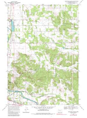
Onehorse Slough Topo Map Oregon
To zoom in, hover over the map of Onehorse Slough
USGS Topo Quad 44122e7 - 1:24,000 scale
| Topo Map Name: | Onehorse Slough |
| USGS Topo Quad ID: | 44122e7 |
| Print Size: | ca. 21 1/4" wide x 27" high |
| Southeast Coordinates: | 44.5° N latitude / 122.75° W longitude |
| Map Center Coordinates: | 44.5625° N latitude / 122.8125° W longitude |
| U.S. State: | OR |
| Filename: | o44122e7.jpg |
| Download Map JPG Image: | Onehorse Slough topo map 1:24,000 scale |
| Map Type: | Topographic |
| Topo Series: | 7.5´ |
| Map Scale: | 1:24,000 |
| Source of Map Images: | United States Geological Survey (USGS) |
| Alternate Map Versions: |
Onehorse Slough OR 1969, updated 1971 Download PDF Buy paper map Onehorse Slough OR 1969, updated 1983 Download PDF Buy paper map Onehorse Slough OR 2011 Download PDF Buy paper map Onehorse Slough OR 2014 Download PDF Buy paper map |
1:24,000 Topo Quads surrounding Onehorse Slough
> Back to 44122e1 at 1:100,000 scale
> Back to 44122a1 at 1:250,000 scale
> Back to U.S. Topo Maps home
Onehorse Slough topo map: Gazetteer
Onehorse Slough: Bridges
Barr Bridge elevation 105m 344′Claypool Bridge elevation 98m 321′
Onehorse Slough: Dams
Lebanon Dam elevation 109m 357′Ornoname 5 Dam elevation 98m 321′
Western Veneer and Plywood Dam elevation 97m 318′
Onehorse Slough: Lakes
Berthelson Pond elevation 186m 610′Calvins Pond elevation 183m 600′
Clarks Pond elevation 125m 410′
Onehorse Slough: Populated Places
Whitaker elevation 113m 370′Onehorse Slough: Post Offices
Abberdeen Post Office (historical) elevation 130m 426′Onehorse Slough: Reservoirs
Davenport Pond elevation 137m 449′Johnson Lake elevation 135m 442′
Little Reservoir elevation 155m 508′
Mystery Hills Reservoir elevation 181m 593′
Snow Peak Log Pond elevation 97m 318′
Taylor Reservoir elevation 149m 488′
Western Log Pond elevation 96m 314′
Western Veneer and Plywood Log Pond elevation 97m 318′
Onehorse Slough: Streams
Carter Creek elevation 117m 383′Cold Spring Creek elevation 93m 305′
First Creek elevation 116m 380′
Hamilton Creek elevation 111m 364′
Onehorse Slough elevation 93m 305′
Vail Creek elevation 112m 367′
Onehorse Slough: Summits
Ridgeway Butte elevation 365m 1197′Onehorse Slough: Valleys
Golden Valley elevation 115m 377′Onehorse Slough digital topo map on disk
Buy this Onehorse Slough topo map showing relief, roads, GPS coordinates and other geographical features, as a high-resolution digital map file on DVD:


