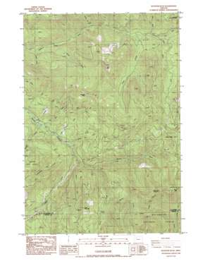
Rooster Rock Topo Map Oregon
To zoom in, hover over the map of Rooster Rock
USGS Topo Quad 44122h3 - 1:24,000 scale
| Topo Map Name: | Rooster Rock |
| USGS Topo Quad ID: | 44122h3 |
| Print Size: | ca. 21 1/4" wide x 27" high |
| Southeast Coordinates: | 44.875° N latitude / 122.25° W longitude |
| Map Center Coordinates: | 44.9375° N latitude / 122.3125° W longitude |
| U.S. State: | OR |
| Filename: | o44122h3.jpg |
| Download Map JPG Image: | Rooster Rock topo map 1:24,000 scale |
| Map Type: | Topographic |
| Topo Series: | 7.5´ |
| Map Scale: | 1:24,000 |
| Source of Map Images: | United States Geological Survey (USGS) |
| Alternate Map Versions: |
Rooster Rock OR 1985, updated 1985 Download PDF Buy paper map Rooster Rock OR 1997, updated 1999 Download PDF Buy paper map Rooster Rock OR 2011 Download PDF Buy paper map Rooster Rock OR 2014 Download PDF Buy paper map |
| FStopo: | US Forest Service topo Rooster Rock is available: Download FStopo PDF Download FStopo TIF |
1:24,000 Topo Quads surrounding Rooster Rock
> Back to 44122e1 at 1:100,000 scale
> Back to 44122a1 at 1:250,000 scale
> Back to U.S. Topo Maps home
Rooster Rock topo map: Gazetteer
Rooster Rock: Basins
The Dungeon elevation 461m 1512′Rooster Rock: Mines
Ogle Mountain Mine elevation 848m 2782′Rooster Rock: Pillars
Nasty Rock elevation 1396m 4580′Rooster Rock elevation 1335m 4379′
Rooster Rock: Streams
Camp Creek elevation 679m 2227′Copper Creek elevation 554m 1817′
Deetee Creek elevation 488m 1601′
Dungeon Creek elevation 474m 1555′
Hay Barn Creek elevation 465m 1525′
Henry Creek elevation 564m 1850′
Hunter Creek elevation 704m 2309′
Image Creek elevation 523m 1715′
Lake Creek elevation 519m 1702′
Lost Creek elevation 720m 2362′
Minette Creek elevation 491m 1610′
Mining Iron Creek elevation 547m 1794′
Ogle Creek elevation 563m 1847′
Poopanelly Creek elevation 552m 1811′
Roland Creek elevation 1285m 4215′
Scorpion Creek elevation 474m 1555′
Wilson Creek elevation 665m 2181′
Rooster Rock: Summits
Burnt Mountain elevation 1442m 4730′Nohorn Butte elevation 1369m 4491′
Table Rock elevation 1462m 4796′
Rooster Rock digital topo map on disk
Buy this Rooster Rock topo map showing relief, roads, GPS coordinates and other geographical features, as a high-resolution digital map file on DVD:


