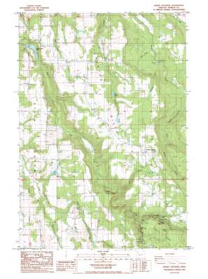
Drake Crossing Topo Map Oregon
To zoom in, hover over the map of Drake Crossing
USGS Topo Quad 44122h6 - 1:24,000 scale
| Topo Map Name: | Drake Crossing |
| USGS Topo Quad ID: | 44122h6 |
| Print Size: | ca. 21 1/4" wide x 27" high |
| Southeast Coordinates: | 44.875° N latitude / 122.625° W longitude |
| Map Center Coordinates: | 44.9375° N latitude / 122.6875° W longitude |
| U.S. State: | OR |
| Filename: | o44122h6.jpg |
| Download Map JPG Image: | Drake Crossing topo map 1:24,000 scale |
| Map Type: | Topographic |
| Topo Series: | 7.5´ |
| Map Scale: | 1:24,000 |
| Source of Map Images: | United States Geological Survey (USGS) |
| Alternate Map Versions: |
Drake Crossing OR 1985, updated 1985 Download PDF Buy paper map Drake Crossing OR 2011 Download PDF Buy paper map Drake Crossing OR 2014 Download PDF Buy paper map |
1:24,000 Topo Quads surrounding Drake Crossing
> Back to 44122e1 at 1:100,000 scale
> Back to 44122a1 at 1:250,000 scale
> Back to U.S. Topo Maps home
Drake Crossing topo map: Gazetteer
Drake Crossing: Dams
Fox Dam elevation 278m 912′Silver Creek Dam elevation 136m 446′
Willards Dam elevation 366m 1200′
Drake Crossing: Falls
Double Falls elevation 318m 1043′Drake Falls elevation 372m 1220′
Drift Creek Falls elevation 300m 984′
Lower North Falls elevation 318m 1043′
Lower South Falls elevation 393m 1289′
Middle North Falls elevation 346m 1135′
South Falls elevation 393m 1289′
Twin Falls elevation 376m 1233′
Winter Falls elevation 421m 1381′
Drake Crossing: Lakes
Willards Pool elevation 366m 1200′Drake Crossing: Parks
Skookum Tum Tum Park elevation 238m 780′Drake Crossing: Populated Places
Drake Crossing elevation 500m 1640′Hullt (historical) elevation 455m 1492′
Drake Crossing: Post Offices
Argenti Post Office (historical) elevation 204m 669′Hullt Post Office (historical) elevation 455m 1492′
Knight Post Office (historical) elevation 367m 1204′
Drake Crossing: Reservoirs
Fox Reservoir elevation 278m 912′Keohler Reservoir elevation 441m 1446′
Pichette Reservoir elevation 243m 797′
Silver Creek Reservoir elevation 136m 446′
Drake Crossing: Streams
Brooks Creek elevation 355m 1164′East Fork Drift Creek elevation 219m 718′
Echo Creek elevation 418m 1371′
Hammond Creek elevation 216m 708′
Jeff Creek elevation 235m 770′
Little Abiqua Creek elevation 238m 780′
North Fork Silver Creek elevation 420m 1377′
South Fork Silver Creek elevation 292m 958′
West Fork Drift Creek elevation 219m 718′
Drake Crossing: Summits
Silverton Hills elevation 462m 1515′Drake Crossing digital topo map on disk
Buy this Drake Crossing topo map showing relief, roads, GPS coordinates and other geographical features, as a high-resolution digital map file on DVD:


