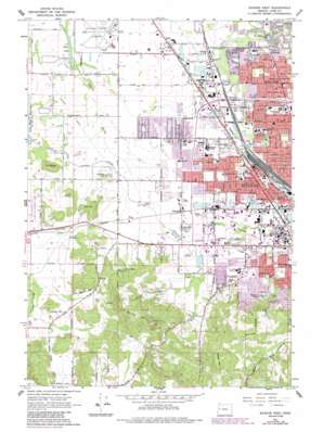
Eugene West Topo Map Oregon
To zoom in, hover over the map of Eugene West
USGS Topo Quad 44123a2 - 1:24,000 scale
| Topo Map Name: | Eugene West |
| USGS Topo Quad ID: | 44123a2 |
| Print Size: | ca. 21 1/4" wide x 27" high |
| Southeast Coordinates: | 44° N latitude / 123.125° W longitude |
| Map Center Coordinates: | 44.0625° N latitude / 123.1875° W longitude |
| U.S. State: | OR |
| Filename: | o44123a2.jpg |
| Download Map JPG Image: | Eugene West topo map 1:24,000 scale |
| Map Type: | Topographic |
| Topo Series: | 7.5´ |
| Map Scale: | 1:24,000 |
| Source of Map Images: | United States Geological Survey (USGS) |
| Alternate Map Versions: |
Eugene West OR 1967, updated 1969 Download PDF Buy paper map Eugene West OR 1967, updated 1977 Download PDF Buy paper map Eugene West OR 1967, updated 1987 Download PDF Buy paper map Eugene West OR 1975, updated 1980 Download PDF Buy paper map Eugene West OR 2011 Download PDF Buy paper map Eugene West OR 2014 Download PDF Buy paper map |
1:24,000 Topo Quads surrounding Eugene West
> Back to 44123a1 at 1:100,000 scale
> Back to 44122a1 at 1:250,000 scale
> Back to U.S. Topo Maps home
Eugene West topo map: Gazetteer
Eugene West: Airports
Mahlon Sweet Field elevation 112m 367′Eugene West: Canals
Amazon Creek Diversion Channel elevation 116m 380′Eugene West: Lakes
Clear Lake elevation 109m 357′Eugene West: Parks
Acorn City Park elevation 124m 406′Arrowhead City Park elevation 116m 380′
Balboa Park elevation 119m 390′
Berkeley City Park elevation 124m 406′
Bramblewood City Park elevation 119m 390′
Candlelight City Park elevation 117m 383′
Churchill Sports Park elevation 124m 406′
Echo Hollow City Park elevation 119m 390′
Emerald Park elevation 121m 396′
Empire Park elevation 120m 393′
Gilbert City Park elevation 123m 403′
Golden Gardens City Park elevation 116m 380′
Hawkins Heights City Park elevation 196m 643′
Irwin City Park elevation 116m 380′
Lark City Park elevation 123m 403′
Mangan City Park elevation 119m 390′
Melvin Miller City Park elevation 229m 751′
Petersen City Park elevation 120m 393′
Skyview City Park elevation 233m 764′
State Street City Park elevation 116m 380′
Trainsong City Park elevation 123m 403′
Walnut Grove City Park elevation 121m 396′
Willow Corner City Park elevation 122m 400′
Eugene West: Populated Places
Bethel elevation 125m 410′Danebo elevation 119m 390′
Fir Grove elevation 116m 380′
Irving elevation 116m 380′
River Road elevation 122m 400′
Santa Clara elevation 119m 390′
Eugene West: Post Offices
Irving Post Office (historical) elevation 116m 380′River Road Post Office (historical) elevation 118m 387′
Eugene West: Reservoirs
City View Reservoir elevation 244m 800′Hawkins Hill Reservoir elevation 188m 616′
Zinker Reservoir elevation 135m 442′
Eugene West: Streams
Willow Creek elevation 119m 390′Eugene West: Summits
Bailey Hill elevation 315m 1033′Cantrell Hill elevation 187m 613′
Crabtree Hill elevation 143m 469′
Fir Butte elevation 176m 577′
Murray Hill elevation 335m 1099′
Oak Hill elevation 202m 662′
Eugene West digital topo map on disk
Buy this Eugene West topo map showing relief, roads, GPS coordinates and other geographical features, as a high-resolution digital map file on DVD:


