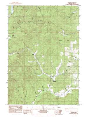
Horton Topo Map Oregon
To zoom in, hover over the map of Horton
USGS Topo Quad 44123b4 - 1:24,000 scale
| Topo Map Name: | Horton |
| USGS Topo Quad ID: | 44123b4 |
| Print Size: | ca. 21 1/4" wide x 27" high |
| Southeast Coordinates: | 44.125° N latitude / 123.375° W longitude |
| Map Center Coordinates: | 44.1875° N latitude / 123.4375° W longitude |
| U.S. State: | OR |
| Filename: | o44123b4.jpg |
| Download Map JPG Image: | Horton topo map 1:24,000 scale |
| Map Type: | Topographic |
| Topo Series: | 7.5´ |
| Map Scale: | 1:24,000 |
| Source of Map Images: | United States Geological Survey (USGS) |
| Alternate Map Versions: |
Horton OR 1984, updated 1984 Download PDF Buy paper map Horton OR 2011 Download PDF Buy paper map Horton OR 2014 Download PDF Buy paper map |
1:24,000 Topo Quads surrounding Horton
> Back to 44123a1 at 1:100,000 scale
> Back to 44122a1 at 1:250,000 scale
> Back to U.S. Topo Maps home
Horton topo map: Gazetteer
Horton: Dams
Hult Log Storage Pond Dam elevation 246m 807′Horton: Gaps
High Pass elevation 464m 1522′Low Pass elevation 327m 1072′
Horton: Parks
Alderwood State Park elevation 174m 570′Blachly Mountain Forest State Park elevation 299m 980′
Horton: Populated Places
Estrup (historical) elevation 238m 780′Horton elevation 229m 751′
Low Pass elevation 187m 613′
Horton: Post Offices
Estrup Post Office (historical) elevation 238m 780′Horton Post Office (historical) elevation 229m 751′
Horton: Reservoirs
Hult Log Storage Reservoir elevation 246m 807′Lower Hult Reservoir elevation 234m 767′
Horton: Ridges
Ballhizer Ridge elevation 358m 1174′Doris Stevens Ridge elevation 423m 1387′
Horton: Springs
Village Creek Spring elevation 253m 830′Horton: Streams
Blacktail Creek elevation 180m 590′Board Creek elevation 157m 515′
Dusky Creek elevation 174m 570′
Howard Branch elevation 179m 587′
Jones Creek elevation 172m 564′
Michaels Creek elevation 180m 590′
Short Jake Creek elevation 169m 554′
Spring Creek elevation 180m 590′
Swamp Creek elevation 170m 557′
Swartz Creek elevation 221m 725′
Village Creek elevation 221m 725′
Horton: Summits
Crenshaw Hill elevation 344m 1128′Horton: Valleys
John Horton Canyon elevation 245m 803′Leibo Canyon elevation 380m 1246′
Lightning Hollow elevation 208m 682′
Rock Canyon elevation 240m 787′
Spring Canyon elevation 234m 767′
Stakely Canyon elevation 236m 774′
Target Canyon elevation 253m 830′
The Hole elevation 253m 830′
Horton digital topo map on disk
Buy this Horton topo map showing relief, roads, GPS coordinates and other geographical features, as a high-resolution digital map file on DVD:


