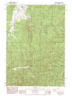
Prairie Peak Topo Map Oregon
To zoom in, hover over the map of Prairie Peak
USGS Topo Quad 44123c5 - 1:24,000 scale
| Topo Map Name: | Prairie Peak |
| USGS Topo Quad ID: | 44123c5 |
| Print Size: | ca. 21 1/4" wide x 27" high |
| Southeast Coordinates: | 44.25° N latitude / 123.5° W longitude |
| Map Center Coordinates: | 44.3125° N latitude / 123.5625° W longitude |
| U.S. State: | OR |
| Filename: | o44123c5.jpg |
| Download Map JPG Image: | Prairie Peak topo map 1:24,000 scale |
| Map Type: | Topographic |
| Topo Series: | 7.5´ |
| Map Scale: | 1:24,000 |
| Source of Map Images: | United States Geological Survey (USGS) |
| Alternate Map Versions: |
Prairie Peak OR 1984, updated 1985 Download PDF Buy paper map Prairie Peak OR 2011 Download PDF Buy paper map Prairie Peak OR 2014 Download PDF Buy paper map |
| FStopo: | US Forest Service topo Prairie Peak is available: Download FStopo PDF Download FStopo TIF |
1:24,000 Topo Quads surrounding Prairie Peak
> Back to 44123a1 at 1:100,000 scale
> Back to 44122a1 at 1:250,000 scale
> Back to U.S. Topo Maps home
Prairie Peak topo map: Gazetteer
Prairie Peak: Gaps
Gunsight Pass elevation 860m 2821′Prairie Peak: Reservoirs
Gygi and Engle Reservoir elevation 208m 682′Prairie Peak: Ridges
Bummer Ridge elevation 498m 1633′Prairie Peak: Streams
Banton Creek elevation 117m 383′Blackberry Creek elevation 215m 705′
Brown Creek elevation 132m 433′
Bummer Creek elevation 85m 278′
Cedar Creek elevation 100m 328′
Dubuque Creek elevation 151m 495′
Headrick Creek elevation 93m 305′
Peak Creek elevation 220m 721′
Record Creek elevation 119m 390′
Rock Creek elevation 199m 652′
Swamp Creek elevation 113m 370′
Tobe Creek elevation 110m 360′
Trout Creek elevation 205m 672′
Wilson Creek elevation 102m 334′
Prairie Peak: Summits
Prairie Mountain elevation 1001m 3284′Prairie Peak elevation 1040m 3412′
Prairie Peak: Valleys
Billy Tower Canyon elevation 279m 915′Prairie Peak digital topo map on disk
Buy this Prairie Peak topo map showing relief, roads, GPS coordinates and other geographical features, as a high-resolution digital map file on DVD:


