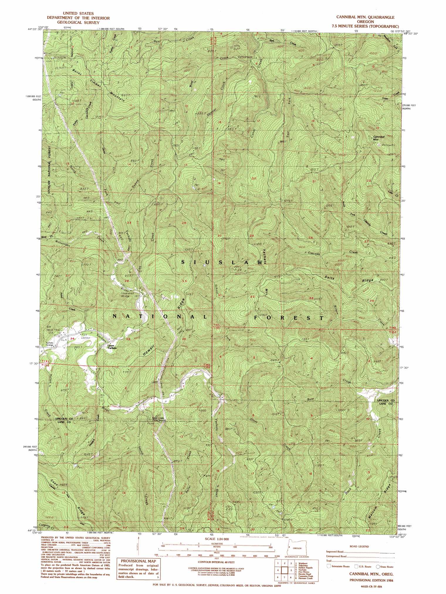
Cannibal Mountain Topo Map Oregon
To zoom in, hover over the map of Cannibal Mountain
USGS Topo Quad 44123c8 - 1:24,000 scale
| Topo Map Name: | Cannibal Mountain |
| USGS Topo Quad ID: | 44123c8 |
| Print Size: | ca. 21 1/4" wide x 27" high |
| Southeast Coordinates: | 44.25° N latitude / 123.875° W longitude |
| Map Center Coordinates: | 44.3125° N latitude / 123.9375° W longitude |
| U.S. State: | OR |
| Filename: | o44123c8.jpg |
| Download Map JPG Image: | Cannibal Mountain topo map 1:24,000 scale |
| Map Type: | Topographic |
| Topo Series: | 7.5´ |
| Map Scale: | 1:24,000 |
| Source of Map Images: | United States Geological Survey (USGS) |
| Alternate Map Versions: |
Cannibal Mtn OR 1984, updated 1985 Download PDF Buy paper map Cannibal Mountain OR 2011 Download PDF Buy paper map Cannibal Mountain OR 2014 Download PDF Buy paper map |
| FStopo: | US Forest Service topo Cannibal Mountain is available: Download FStopo PDF Download FStopo TIF |
1:24,000 Topo Quads surrounding Cannibal Mountain
Newport South |
Toledo South |
Elk City |
Harlan |
|
Waldport |
Tidewater |
Hellion Rapids |
Grass Mountain |
|
Yachats |
Cannibal Mountain |
Five Rivers |
Digger Mountain |
|
Heceta Head |
Cummins Peak |
Herman Creek |
Windy Peak |
|
Mercer Lake |
Tiernan |
Mapleton |
Greenleaf |
> Back to 44123a1 at 1:100,000 scale
> Back to 44122a1 at 1:250,000 scale
> Back to U.S. Topo Maps home
Cannibal Mountain topo map: Gazetteer
Cannibal Mountain: Flats
Durbin Meadows elevation 149m 488′Cannibal Mountain: Forests
Siuslaw National Forest elevation 382m 1253′Cannibal Mountain: Populated Places
Euclid (historical) elevation 107m 351′Cannibal Mountain: Post Offices
Axtell Post Office (historical) elevation 34m 111′Euclid Post Office (historical) elevation 107m 351′
Cannibal Mountain: Ridges
Howell Ridge elevation 222m 728′Malcolm Ridge elevation 315m 1033′
Seits Ridge elevation 345m 1131′
Yachats Ridge elevation 384m 1259′
Cannibal Mountain: Streams
Axtell Creek elevation 32m 104′Depew Creek elevation 81m 265′
Earley Creek elevation 150m 492′
East Fork Canal Creek elevation 80m 262′
Fish Creek elevation 50m 164′
Glines Creek elevation 113m 370′
Grass Creek elevation 98m 321′
Helms Creek elevation 33m 108′
Keller Creek elevation 58m 190′
Neiglick Creek elevation 61m 200′
North Fork Yachats River elevation 36m 118′
Red Creek elevation 42m 137′
School Fork elevation 85m 278′
Skinner Creek elevation 59m 193′
Stump Creek elevation 71m 232′
West Creek elevation 49m 160′
West Fork Williamson Creek elevation 95m 311′
Williamson Creek elevation 60m 196′
Wilson Creek elevation 75m 246′
Cannibal Mountain: Summits
Burnt Timber Mountain elevation 504m 1653′Cannibal Mountain elevation 590m 1935′
Cannibal Mountain digital topo map on disk
Buy this Cannibal Mountain topo map showing relief, roads, GPS coordinates and other geographical features, as a high-resolution digital map file on DVD: