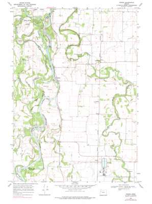
Peoria Topo Map Oregon
To zoom in, hover over the map of Peoria
USGS Topo Quad 44123d2 - 1:24,000 scale
| Topo Map Name: | Peoria |
| USGS Topo Quad ID: | 44123d2 |
| Print Size: | ca. 21 1/4" wide x 27" high |
| Southeast Coordinates: | 44.375° N latitude / 123.125° W longitude |
| Map Center Coordinates: | 44.4375° N latitude / 123.1875° W longitude |
| U.S. State: | OR |
| Filename: | o44123d2.jpg |
| Download Map JPG Image: | Peoria topo map 1:24,000 scale |
| Map Type: | Topographic |
| Topo Series: | 7.5´ |
| Map Scale: | 1:24,000 |
| Source of Map Images: | United States Geological Survey (USGS) |
| Alternate Map Versions: |
Peoria OR 1969, updated 1971 Download PDF Buy paper map Peoria OR 1969, updated 1977 Download PDF Buy paper map Peoria OR 2011 Download PDF Buy paper map Peoria OR 2014 Download PDF Buy paper map |
1:24,000 Topo Quads surrounding Peoria
> Back to 44123a1 at 1:100,000 scale
> Back to 44122a1 at 1:250,000 scale
> Back to U.S. Topo Maps home
Peoria topo map: Gazetteer
Peoria: Airports
Pugh Landing Strip elevation 78m 255′Peoria: Bends
Jacobs Bend elevation 75m 246′Sam Daws Bend elevation 76m 249′
Snag Boat Bend elevation 73m 239′
Peoria: Channels
Albany Channel elevation 72m 236′Peoria: Guts
Clark Slough elevation 68m 223′McBee Slough elevation 72m 236′
Peoria: Islands
Baker Island elevation 71m 232′Bear Island elevation 70m 229′
Centennial Island elevation 70m 229′
Hoacum Island elevation 76m 249′
Horseshoe Island elevation 71m 232′
McBee Island elevation 71m 232′
Norwood Island elevation 80m 262′
Peoria: Lakes
Porter Lake elevation 71m 232′Riser Lake elevation 71m 232′
Peoria: Parks
Peoria County Park elevation 79m 259′Peoria: Populated Places
Burlington (historical) elevation 79m 259′Peoria elevation 79m 259′
Peoria: Post Offices
Burlington Post Office (historical) elevation 79m 259′Peoria Post Office (historical) elevation 79m 259′
Peoria: Streams
Camous Creek elevation 83m 272′Johnston Slough elevation 77m 252′
Lake Creek elevation 72m 236′
Long Tom River elevation 78m 255′
Peoria digital topo map on disk
Buy this Peoria topo map showing relief, roads, GPS coordinates and other geographical features, as a high-resolution digital map file on DVD:


