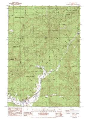
Alsea Topo Map Oregon
To zoom in, hover over the map of Alsea
USGS Topo Quad 44123d5 - 1:24,000 scale
| Topo Map Name: | Alsea |
| USGS Topo Quad ID: | 44123d5 |
| Print Size: | ca. 21 1/4" wide x 27" high |
| Southeast Coordinates: | 44.375° N latitude / 123.5° W longitude |
| Map Center Coordinates: | 44.4375° N latitude / 123.5625° W longitude |
| U.S. State: | OR |
| Filename: | o44123d5.jpg |
| Download Map JPG Image: | Alsea topo map 1:24,000 scale |
| Map Type: | Topographic |
| Topo Series: | 7.5´ |
| Map Scale: | 1:24,000 |
| Source of Map Images: | United States Geological Survey (USGS) |
| Alternate Map Versions: |
Alsea OR 1985, updated 1985 Download PDF Buy paper map Alsea OR 2011 Download PDF Buy paper map Alsea OR 2014 Download PDF Buy paper map |
| FStopo: | US Forest Service topo Alsea is available: Download FStopo PDF Download FStopo TIF |
1:24,000 Topo Quads surrounding Alsea
> Back to 44123a1 at 1:100,000 scale
> Back to 44122a1 at 1:250,000 scale
> Back to U.S. Topo Maps home
Alsea topo map: Gazetteer
Alsea: Gaps
Alsea Summit elevation 369m 1210′Alsea: Parks
Clemens County Park elevation 104m 341′Alsea: Populated Places
Alsea elevation 89m 291′Alsea: Post Offices
Alsea Post Office elevation 89m 291′Alsea: Ridges
Easter Ridge elevation 633m 2076′Alsea: Springs
Cathcart Springs elevation 204m 669′Alsea: Streams
Alder Creek elevation 243m 797′Arnold Creek elevation 115m 377′
Bailey Creek elevation 109m 357′
Baker Creek elevation 120m 393′
Beaty Creek elevation 80m 262′
Cabin Creek elevation 169m 554′
Cathcart Creek elevation 82m 269′
Chittam Creek elevation 362m 1187′
Crooked Creek elevation 111m 364′
Easter Creek elevation 205m 672′
Ernest Creek elevation 137m 449′
Gravel Creek elevation 163m 534′
Hayden Creek elevation 98m 321′
Honey Grove Creek elevation 93m 305′
Kiger Creek elevation 87m 285′
Little Alder Creek elevation 219m 718′
Mill Creek elevation 114m 374′
North Fork Alsea River elevation 84m 275′
Parker Creek elevation 269m 882′
Roberts Creek elevation 80m 262′
Ryder Creek elevation 94m 308′
Salmon Creek elevation 124m 406′
Seeley Creek elevation 107m 351′
Slide Creek elevation 254m 833′
South Fork Alsea River elevation 84m 275′
Yew Creek elevation 203m 666′
Zahn Creek elevation 159m 521′
Alsea: Summits
Doe Mountain elevation 491m 1610′Maddsens Knob elevation 664m 2178′
Old Blue Mountain elevation 1003m 3290′
Alsea digital topo map on disk
Buy this Alsea topo map showing relief, roads, GPS coordinates and other geographical features, as a high-resolution digital map file on DVD:


