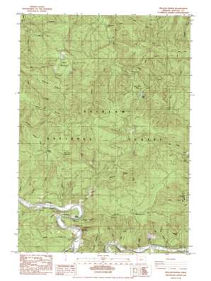
Hellion Rapids Topo Map Oregon
To zoom in, hover over the map of Hellion Rapids
USGS Topo Quad 44123d7 - 1:24,000 scale
| Topo Map Name: | Hellion Rapids |
| USGS Topo Quad ID: | 44123d7 |
| Print Size: | ca. 21 1/4" wide x 27" high |
| Southeast Coordinates: | 44.375° N latitude / 123.75° W longitude |
| Map Center Coordinates: | 44.4375° N latitude / 123.8125° W longitude |
| U.S. State: | OR |
| Filename: | o44123d7.jpg |
| Download Map JPG Image: | Hellion Rapids topo map 1:24,000 scale |
| Map Type: | Topographic |
| Topo Series: | 7.5´ |
| Map Scale: | 1:24,000 |
| Source of Map Images: | United States Geological Survey (USGS) |
| Alternate Map Versions: |
Hellion Rapids OR 1984, updated 1985 Download PDF Buy paper map Hellion Rapids OR 2011 Download PDF Buy paper map Hellion Rapids OR 2014 Download PDF Buy paper map |
| FStopo: | US Forest Service topo Hellion Rapids is available: Download FStopo PDF Download FStopo TIF |
1:24,000 Topo Quads surrounding Hellion Rapids
> Back to 44123a1 at 1:100,000 scale
> Back to 44122a1 at 1:250,000 scale
> Back to U.S. Topo Maps home
Hellion Rapids topo map: Gazetteer
Hellion Rapids: Benches
Surveyors Benches elevation 405m 1328′Hellion Rapids: Gaps
Trenholm Saddle elevation 229m 751′Hellion Rapids: Lakes
Ayers Lake elevation 349m 1145′Hellion Rapids: Rapids
Hellion Rapids elevation 21m 68′Hellion Rapids: Ridges
Death Ridge elevation 574m 1883′Hellion Ridge elevation 146m 479′
Middle Ridge elevation 417m 1368′
Peavine Ridge elevation 596m 1955′
West Ridge elevation 609m 1998′
Hellion Rapids: Slopes
Upper Drift Creek Slide elevation 472m 1548′Hellion Rapids: Springs
Cold Spring elevation 581m 1906′Klickitat Spring elevation 664m 2178′
Hellion Rapids: Streams
Barclay Creek elevation 11m 36′Bear Creek elevation 43m 141′
Brush Creek elevation 19m 62′
Butler Creek elevation 36m 118′
Cedar Creek elevation 41m 134′
Cow Creek elevation 45m 147′
East Fork Scott Creek elevation 49m 160′
Grass Creek elevation 298m 977′
Meander Along Creek elevation 5m 16′
Minotti Creek elevation 45m 147′
North Fork Drift Creek elevation 256m 839′
Nye Creek elevation 105m 344′
Phillips Creek elevation 43m 141′
Rock Creek elevation 147m 482′
Schoolhouse Creek elevation 22m 72′
Scott Creek elevation 12m 39′
Slide Creek elevation 10m 32′
Slide Creek elevation 229m 751′
Smallwood Creek elevation 27m 88′
South Fork Drift Creek elevation 228m 748′
Table Mountain Creek elevation 338m 1108′
West Fork Scott Creek elevation 49m 160′
Wolf Creek elevation 43m 141′
Hellion Rapids: Summits
Scott Mountain elevation 467m 1532′Stoney Mountain elevation 312m 1023′
Table Mountain elevation 834m 2736′
Hellion Rapids: Valleys
Carns Canyon elevation 110m 360′Hellion Canyon elevation 36m 118′
Hellion Rapids digital topo map on disk
Buy this Hellion Rapids topo map showing relief, roads, GPS coordinates and other geographical features, as a high-resolution digital map file on DVD:


