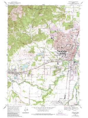
Corvallis Topo Map Oregon
To zoom in, hover over the map of Corvallis
USGS Topo Quad 44123e3 - 1:24,000 scale
| Topo Map Name: | Corvallis |
| USGS Topo Quad ID: | 44123e3 |
| Print Size: | ca. 21 1/4" wide x 27" high |
| Southeast Coordinates: | 44.5° N latitude / 123.25° W longitude |
| Map Center Coordinates: | 44.5625° N latitude / 123.3125° W longitude |
| U.S. State: | OR |
| Filename: | o44123e3.jpg |
| Download Map JPG Image: | Corvallis topo map 1:24,000 scale |
| Map Type: | Topographic |
| Topo Series: | 7.5´ |
| Map Scale: | 1:24,000 |
| Source of Map Images: | United States Geological Survey (USGS) |
| Alternate Map Versions: |
Corvallis OR 1969, updated 1973 Download PDF Buy paper map Corvallis OR 1969, updated 1978 Download PDF Buy paper map Corvallis OR 1969, updated 1987 Download PDF Buy paper map Corvallis OR 1975, updated 1980 Download PDF Buy paper map Corvallis OR 2011 Download PDF Buy paper map Corvallis OR 2014 Download PDF Buy paper map |
| FStopo: | US Forest Service topo Corvallis is available: Download FStopo PDF Download FStopo TIF |
1:24,000 Topo Quads surrounding Corvallis
> Back to 44123e1 at 1:100,000 scale
> Back to 44122a1 at 1:250,000 scale
> Back to U.S. Topo Maps home
Corvallis topo map: Gazetteer
Corvallis: Airports
Good Samaritan Hospital Heliport elevation 107m 351′Skirvin Air Park elevation 80m 262′
Corvallis: Channels
Booneville Channel elevation 65m 213′West Fork Booneville Channel elevation 66m 216′
Corvallis: Dams
Clemens Log Pond Dam elevation 91m 298′Hobin Dam elevation 81m 265′
Ornoname 14 Dam elevation 86m 282′
Corvallis: Lakes
Crystal Lake elevation 65m 213′Corvallis: Parks
Alan B Berg City Park elevation 64m 209′Arnold City Park elevation 82m 269′
Avery City Park elevation 69m 226′
Brandis City Park elevation 161m 528′
Central City Park elevation 71m 232′
Chintimini City Park elevation 74m 242′
Chip Ross City Park elevation 85m 278′
Cloverland City Park elevation 76m 249′
Fitton Green County Natural Area elevation 244m 800′
Franklin City Park elevation 72m 236′
Garfield City Park elevation 71m 232′
Kermit E Roth City Park elevation 69m 226′
Lilly City Park elevation 72m 236′
Martin Luther King Junior City Park elevation 66m 216′
Oak Creek City Park elevation 68m 223′
Peanut City Park elevation 72m 236′
Pioneer Boat Basin City Park elevation 65m 213′
Pioneer City Park elevation 65m 213′
Porter City Park elevation 71m 232′
Riverfront Commemorative City Park elevation 71m 232′
Starker City Park elevation 74m 242′
Sunset City Park elevation 74m 242′
Timberhill City Park elevation 85m 278′
Tunison City Park elevation 66m 216′
Walnut City Park elevation 125m 410′
Washington City Park elevation 68m 223′
Wildcat City Park elevation 73m 239′
Willamette City Park elevation 67m 219′
Corvallis: Populated Places
Corvallis elevation 71m 232′Dry Creek elevation 74m 242′
Philomath elevation 86m 282′
Corvallis: Post Offices
Brown Post Office (historical) elevation 97m 318′Campus Post Office (historical) elevation 76m 249′
Corvallis Post Office elevation 69m 226′
Navy 13003 Post Office (historical) elevation 74m 242′
Navy 13023 Post Office (historical) elevation 74m 242′
Philomath Post Office elevation 86m 282′
Corvallis: Reservoirs
Clemens Log Pond elevation 91m 298′Corvallis Reservoir elevation 125m 410′
Hobin Log Pond elevation 81m 265′
Larson Log Pond elevation 84m 275′
Peak Log Pond elevation 187m 613′
Corvallis: Streams
Alder Creek elevation 114m 374′Booneville Slough elevation 66m 216′
Buttermilk Creek elevation 88m 288′
Dixon Creek elevation 62m 203′
Dry Creek elevation 66m 216′
Dunawi Creek elevation 62m 203′
Evergreen Creek elevation 69m 226′
Marys River elevation 63m 206′
Millrace elevation 63m 206′
Muddy Creek elevation 67m 219′
Mulkey Creek elevation 92m 301′
Newton Creek elevation 76m 249′
Oak Creek elevation 63m 206′
Skunk Creek elevation 116m 380′
Corvallis: Summits
Bald Hill elevation 229m 751′Dimple Hill elevation 455m 1492′
Witham Hill elevation 149m 488′
Corvallis digital topo map on disk
Buy this Corvallis topo map showing relief, roads, GPS coordinates and other geographical features, as a high-resolution digital map file on DVD:


