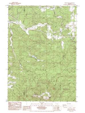
Marys Peak Topo Map Oregon
To zoom in, hover over the map of Marys Peak
USGS Topo Quad 44123e5 - 1:24,000 scale
| Topo Map Name: | Marys Peak |
| USGS Topo Quad ID: | 44123e5 |
| Print Size: | ca. 21 1/4" wide x 27" high |
| Southeast Coordinates: | 44.5° N latitude / 123.5° W longitude |
| Map Center Coordinates: | 44.5625° N latitude / 123.5625° W longitude |
| U.S. State: | OR |
| Filename: | o44123e5.jpg |
| Download Map JPG Image: | Marys Peak topo map 1:24,000 scale |
| Map Type: | Topographic |
| Topo Series: | 7.5´ |
| Map Scale: | 1:24,000 |
| Source of Map Images: | United States Geological Survey (USGS) |
| Alternate Map Versions: |
Marys Peak OR 1984, updated 1984 Download PDF Buy paper map Marys Peak OR 1984, updated 1984 Download PDF Buy paper map Marys Peak OR 2011 Download PDF Buy paper map Marys Peak OR 2014 Download PDF Buy paper map |
| FStopo: | US Forest Service topo Marys Peak is available: Download FStopo PDF Download FStopo TIF |
1:24,000 Topo Quads surrounding Marys Peak
> Back to 44123e1 at 1:100,000 scale
> Back to 44122a1 at 1:250,000 scale
> Back to U.S. Topo Maps home
Marys Peak topo map: Gazetteer
Marys Peak: Dams
Thompson Dam elevation 223m 731′Marys Peak: Parks
Corvallis Watershed Wild Animal Refuge elevation 351m 1151′Marys Peak Botanical Special Interest Area elevation 1199m 3933′
Noble Fir Management Buffer Zone elevation 918m 3011′
Marys Peak: Populated Places
Alder elevation 184m 603′Blodgett elevation 193m 633′
Burnt Woods elevation 210m 688′
Peak (historical) elevation 423m 1387′
Marys Peak: Post Offices
Blodgett Post Office elevation 193m 633′Burnt Woods Post Office (historical) elevation 210m 688′
Devitt Post Office (historical) elevation 195m 639′
Peak Post Office (historical) elevation 423m 1387′
Wesley Post Office (historical) elevation 368m 1207′
Marys Peak: Reservoirs
Thompson Lake elevation 223m 731′Marys Peak: Ridges
Shroyer Ridge elevation 318m 1043′West Ridge elevation 1107m 3631′
Marys Peak: Streams
Bark Creek elevation 202m 662′Chintimini Creek elevation 388m 1272′
Clark Creek elevation 196m 643′
Devitt Creek elevation 190m 623′
Hymes Creek elevation 204m 669′
Lasky Creek elevation 188m 616′
Norton Creek elevation 178m 583′
Scheele Creek elevation 189m 620′
Shotpouch Creek elevation 208m 682′
Tumtum River elevation 178m 583′
Marys Peak: Summits
Dudlee Hill elevation 313m 1026′Marys Peak elevation 1229m 4032′
Marys Peak digital topo map on disk
Buy this Marys Peak topo map showing relief, roads, GPS coordinates and other geographical features, as a high-resolution digital map file on DVD:


