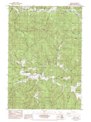
Harlan Topo Map Oregon
To zoom in, hover over the map of Harlan
USGS Topo Quad 44123e6 - 1:24,000 scale
| Topo Map Name: | Harlan |
| USGS Topo Quad ID: | 44123e6 |
| Print Size: | ca. 21 1/4" wide x 27" high |
| Southeast Coordinates: | 44.5° N latitude / 123.625° W longitude |
| Map Center Coordinates: | 44.5625° N latitude / 123.6875° W longitude |
| U.S. State: | OR |
| Filename: | o44123e6.jpg |
| Download Map JPG Image: | Harlan topo map 1:24,000 scale |
| Map Type: | Topographic |
| Topo Series: | 7.5´ |
| Map Scale: | 1:24,000 |
| Source of Map Images: | United States Geological Survey (USGS) |
| Alternate Map Versions: |
Harlan OR 1984, updated 1984 Download PDF Buy paper map Harlan OR 2011 Download PDF Buy paper map Harlan OR 2014 Download PDF Buy paper map |
| FStopo: | US Forest Service topo Harlan is available: Download FStopo PDF Download FStopo TIF |
1:24,000 Topo Quads surrounding Harlan
> Back to 44123e1 at 1:100,000 scale
> Back to 44122a1 at 1:250,000 scale
> Back to U.S. Topo Maps home
Harlan topo map: Gazetteer
Harlan: Capes
Chinquapin Point elevation 333m 1092′Harlan: Gaps
Cline Hill Summit elevation 235m 770′Harlan: Lakes
Bradish Lake elevation 134m 439′Harlan: Parks
Ellmaker State Wayside elevation 225m 738′Harlan: Populated Places
Harlan elevation 75m 246′Harlan: Post Offices
Barber Post Office (historical) elevation 62m 203′Harlan Post Office (historical) elevation 75m 246′
Harlan: Ridges
Chinquapin Ridge elevation 289m 948′Goat Ridge elevation 440m 1443′
Grant Ridge elevation 405m 1328′
Strom Boulder Ridge elevation 426m 1397′
Taylor Ridge elevation 399m 1309′
Harlan: Streams
Adams Creek elevation 92m 301′Austin Creek elevation 70m 229′
Baker Creek elevation 92m 301′
Beaver Creek elevation 213m 698′
Beaverdam Creek elevation 106m 347′
Bevens Creek elevation 53m 173′
Branch Creek elevation 102m 334′
Cline Creek elevation 77m 252′
Cougar Creek elevation 90m 295′
Coyote Creek elevation 91m 298′
Ellmaker Creek elevation 219m 718′
Feagles Creek elevation 73m 239′
Grant Creek elevation 65m 213′
Johnson Creek elevation 112m 367′
Lake Creek elevation 97m 318′
Leverage Creek elevation 170m 557′
Little Creek elevation 85m 278′
Little Wolf Creek elevation 82m 269′
Miller Creek elevation 70m 229′
Oglesby Creek elevation 48m 157′
Perry Creek elevation 48m 157′
Peterson Creek elevation 135m 442′
Rail Creek elevation 84m 275′
Salmon Creek elevation 44m 144′
Savage Creek elevation 97m 318′
Spout Creek elevation 73m 239′
Sugarbowl Creek elevation 85m 278′
Wakefield Creek elevation 61m 200′
West Fork Feagles Creek elevation 115m 377′
Whiskey Creek elevation 45m 147′
Wolf Creek elevation 55m 180′
Harlan: Summits
Baldy elevation 367m 1204′Cline Hill elevation 325m 1066′
Harlan: Valleys
Big Elk Valley elevation 73m 239′Crawford Canyon elevation 94m 308′
Harlan digital topo map on disk
Buy this Harlan topo map showing relief, roads, GPS coordinates and other geographical features, as a high-resolution digital map file on DVD:


