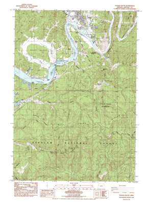
Toledo South Topo Map Oregon
To zoom in, hover over the map of Toledo South
USGS Topo Quad 44123e8 - 1:24,000 scale
| Topo Map Name: | Toledo South |
| USGS Topo Quad ID: | 44123e8 |
| Print Size: | ca. 21 1/4" wide x 27" high |
| Southeast Coordinates: | 44.5° N latitude / 123.875° W longitude |
| Map Center Coordinates: | 44.5625° N latitude / 123.9375° W longitude |
| U.S. State: | OR |
| Filename: | o44123e8.jpg |
| Download Map JPG Image: | Toledo South topo map 1:24,000 scale |
| Map Type: | Topographic |
| Topo Series: | 7.5´ |
| Map Scale: | 1:24,000 |
| Source of Map Images: | United States Geological Survey (USGS) |
| Alternate Map Versions: |
Toledo South OR 1984, updated 1984 Download PDF Buy paper map Toledo South OR 2011 Download PDF Buy paper map Toledo South OR 2014 Download PDF Buy paper map |
| FStopo: | US Forest Service topo Toledo South is available: Download FStopo PDF Download FStopo TIF |
1:24,000 Topo Quads surrounding Toledo South
> Back to 44123e1 at 1:100,000 scale
> Back to 44122a1 at 1:250,000 scale
> Back to U.S. Topo Maps home
Toledo South topo map: Gazetteer
Toledo South: Airports
Toledo State Airport elevation 3m 9′Toledo South: Areas
City of Toledo Watershed elevation 159m 521′Toledo South: Bridges
Butler Bridge elevation 0m 0′Dundon Bridge elevation 1m 3′
Toledo South: Capes
Grassy Point elevation 2m 6′Green Point elevation 2m 6′
Toledo South: Dams
Mill Creek Dam elevation 56m 183′Toledo South: Guts
Tokyo Slough elevation -2m -7′Toledo South: Islands
Boone Island elevation 89m 291′Toledo South: Parks
Cannon Quarry County Park elevation 5m 16′Memorial Lumbermans Park elevation 163m 534′
Toledo South: Populated Places
Elk City elevation 105m 344′Sunnyridge elevation 75m 246′
Toledo elevation 6m 19′
Toledo South: Post Offices
Elk City Post Office (historical) elevation 6m 19′Toledo Post Office elevation 6m 19′
Toledo South: Reservoirs
Mill Creek Reservoir elevation 56m 183′Olalla Barrier Reservoir elevation 7m 22′
Toledo South: Ridges
Craigie Point elevation 0m 0′Mill Creek Divide elevation 399m 1309′
Peterson Ridge elevation 237m 777′
Sunny Ridge elevation 64m 209′
The Hogback elevation 310m 1017′
Toledo South: Streams
Abbey Creek elevation 33m 108′Alexander Creek elevation 25m 82′
Babcock Creek elevation 2m 6′
Blue Creek elevation 5m 16′
Boone Slough elevation 1m 3′
Chetco Slough elevation 3m 9′
Deer Creek elevation 191m 626′
Depot Slough elevation 0m 0′
East Fork Mill Creek elevation 56m 183′
Flesher Slough elevation 0m 0′
Hinton Slough elevation 0m 0′
Johnson Slough elevation 2m 6′
Lewis Creek elevation 51m 167′
Mill Creek elevation 2m 6′
Montgomery Creek elevation 0m 0′
Nute Slough elevation 0m 0′
Olalla Slough elevation 0m 0′
Slack Creek elevation 79m 259′
Wright Creek elevation 4m 13′
Toledo South: Summits
Strawberry Mountain elevation 203m 666′Toledo South: Trails
Horse Creek Trail elevation 419m 1374′Toledo South digital topo map on disk
Buy this Toledo South topo map showing relief, roads, GPS coordinates and other geographical features, as a high-resolution digital map file on DVD:


