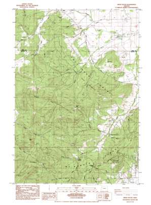
Airlie South Topo Map Oregon
To zoom in, hover over the map of Airlie South
USGS Topo Quad 44123f3 - 1:24,000 scale
| Topo Map Name: | Airlie South |
| USGS Topo Quad ID: | 44123f3 |
| Print Size: | ca. 21 1/4" wide x 27" high |
| Southeast Coordinates: | 44.625° N latitude / 123.25° W longitude |
| Map Center Coordinates: | 44.6875° N latitude / 123.3125° W longitude |
| U.S. State: | OR |
| Filename: | o44123f3.jpg |
| Download Map JPG Image: | Airlie South topo map 1:24,000 scale |
| Map Type: | Topographic |
| Topo Series: | 7.5´ |
| Map Scale: | 1:24,000 |
| Source of Map Images: | United States Geological Survey (USGS) |
| Alternate Map Versions: |
Airlie South OR 1984, updated 1984 Download PDF Buy paper map Airlie South OR 1984, updated 1984 Download PDF Buy paper map Airlie South OR 2011 Download PDF Buy paper map Airlie South OR 2014 Download PDF Buy paper map |
1:24,000 Topo Quads surrounding Airlie South
> Back to 44123e1 at 1:100,000 scale
> Back to 44122a1 at 1:250,000 scale
> Back to U.S. Topo Maps home
Airlie South topo map: Gazetteer
Airlie South: Areas
Crescent Valley elevation 90m 295′Airlie South: Forests
Adair Tract State Forest elevation 272m 892′McDonald State Forest elevation 247m 810′
Airlie South: Gaps
Lewisburg Saddle elevation 289m 948′Airlie South: Parks
Bald Hill City Park elevation 160m 524′Airlie South: Ranges
Cardwell Hills elevation 595m 1952′Airlie South: Reservoirs
Johnson Reservoir elevation 104m 341′Kenney Reservoir elevation 96m 314′
Kester Pond elevation 62m 203′
Oakshire Reservoir elevation 90m 295′
Airlie South: Springs
Sulphur Springs elevation 160m 524′Airlie South: Streams
Baker Creek elevation 157m 515′Fuller Creek elevation 148m 485′
Middle Fork Berry Creek elevation 101m 331′
North Fork Berry Creek elevation 103m 337′
Peterson Creek elevation 63m 206′
South Fork Berry Creek elevation 101m 331′
Spring Branch elevation 109m 357′
Staats Creek elevation 65m 213′
Writsman Brook elevation 111m 364′
Airlie South: Summits
Forest Peak elevation 569m 1866′Oak Hill elevation 114m 374′
Pride Peak elevation 531m 1742′
Smith Hill elevation 205m 672′
Vineyard Mountain elevation 443m 1453′
Airlie South: Valleys
Staats Hollow elevation 107m 351′Airlie South digital topo map on disk
Buy this Airlie South topo map showing relief, roads, GPS coordinates and other geographical features, as a high-resolution digital map file on DVD:


