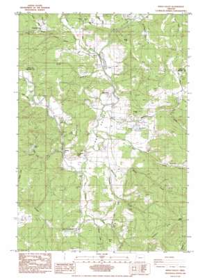
Kings Valley Topo Map Oregon
To zoom in, hover over the map of Kings Valley
USGS Topo Quad 44123f4 - 1:24,000 scale
| Topo Map Name: | Kings Valley |
| USGS Topo Quad ID: | 44123f4 |
| Print Size: | ca. 21 1/4" wide x 27" high |
| Southeast Coordinates: | 44.625° N latitude / 123.375° W longitude |
| Map Center Coordinates: | 44.6875° N latitude / 123.4375° W longitude |
| U.S. State: | OR |
| Filename: | o44123f4.jpg |
| Download Map JPG Image: | Kings Valley topo map 1:24,000 scale |
| Map Type: | Topographic |
| Topo Series: | 7.5´ |
| Map Scale: | 1:24,000 |
| Source of Map Images: | United States Geological Survey (USGS) |
| Alternate Map Versions: |
Kings Valley OR 1984, updated 1984 Download PDF Buy paper map Kings Valley OR 2011 Download PDF Buy paper map Kings Valley OR 2014 Download PDF Buy paper map |
1:24,000 Topo Quads surrounding Kings Valley
> Back to 44123e1 at 1:100,000 scale
> Back to 44122a1 at 1:250,000 scale
> Back to U.S. Topo Maps home
Kings Valley topo map: Gazetteer
Kings Valley: Basins
Kings Valley elevation 101m 331′Kings Valley: Bridges
Ritner Creek Bridge elevation 88m 288′Kings Valley: Dams
Emery Moore Dam elevation 130m 426′Whispering Winds Dam elevation 127m 416′
Kings Valley: Parks
Beazell Memorial County Forest elevation 189m 620′Fort Hoskins Historic County Park elevation 118m 387′
Ritner Creek County Park elevation 110m 360′
Kings Valley: Populated Places
Hoskins elevation 105m 344′Kings Valley elevation 97m 318′
Kings Valley: Post Offices
Hoskins Post Office (historical) elevation 105m 344′Kings Valley Post Office (historical) elevation 97m 318′
Kings Valley: Reservoirs
Bonner Lake elevation 151m 495′Emery Moore Reservoir elevation 130m 426′
Lake of the Winds elevation 135m 442′
Mitchell Reservoir elevation 145m 475′
Price Creek Reservoir elevation 182m 597′
Whispering Winds Reservoir elevation 127m 416′
Kings Valley: Ridges
Dunn Ridge elevation 270m 885′Kings Valley: Springs
Fort Hoskins Spring elevation 152m 498′Kings Valley: Streams
Alexander Creek elevation 121m 396′Bonner Creek elevation 141m 462′
Bump Creek elevation 89m 291′
Burgett Creek elevation 117m 383′
Clayton Creek elevation 93m 305′
Foster Creek elevation 111m 364′
Kinsey Creek elevation 91m 298′
Love Creek elevation 102m 334′
Maxfield Creek elevation 90m 295′
Pedee Creek elevation 118m 387′
Plunkett Creek elevation 99m 324′
Price Creek elevation 94m 308′
Ritner Creek elevation 86m 282′
Sheythe Creek elevation 105m 344′
Vincent Creek elevation 99m 324′
Watson Creek elevation 131m 429′
Woods Creek elevation 111m 364′
Kings Valley: Summits
Bonner Mountain elevation 286m 938′Burgett Hill elevation 192m 629′
Grant Hill elevation 253m 830′
Hayes Hill elevation 271m 889′
Kings Valley digital topo map on disk
Buy this Kings Valley topo map showing relief, roads, GPS coordinates and other geographical features, as a high-resolution digital map file on DVD:


