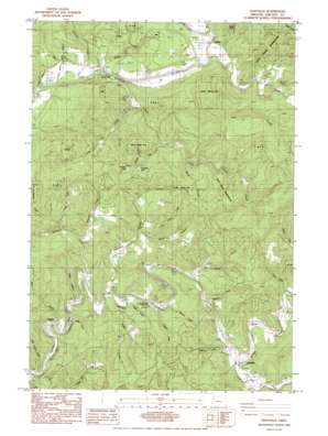
Eddyville Topo Map Oregon
To zoom in, hover over the map of Eddyville
USGS Topo Quad 44123f7 - 1:24,000 scale
| Topo Map Name: | Eddyville |
| USGS Topo Quad ID: | 44123f7 |
| Print Size: | ca. 21 1/4" wide x 27" high |
| Southeast Coordinates: | 44.625° N latitude / 123.75° W longitude |
| Map Center Coordinates: | 44.6875° N latitude / 123.8125° W longitude |
| U.S. State: | OR |
| Filename: | o44123f7.jpg |
| Download Map JPG Image: | Eddyville topo map 1:24,000 scale |
| Map Type: | Topographic |
| Topo Series: | 7.5´ |
| Map Scale: | 1:24,000 |
| Source of Map Images: | United States Geological Survey (USGS) |
| Alternate Map Versions: |
Eddyville OR 1984, updated 1984 Download PDF Buy paper map Eddyville OR 2011 Download PDF Buy paper map Eddyville OR 2014 Download PDF Buy paper map |
1:24,000 Topo Quads surrounding Eddyville
> Back to 44123e1 at 1:100,000 scale
> Back to 44122a1 at 1:250,000 scale
> Back to U.S. Topo Maps home
Eddyville topo map: Gazetteer
Eddyville: Bridges
Orton Bridge elevation 55m 180′Eddyville: Lakes
Derrick Lake elevation 156m 511′Trembley Lake elevation 112m 367′
Eddyville: Parks
Twin Bridges County Park elevation 49m 160′Eddyville: Populated Places
Chitwood elevation 43m 141′Eddyville elevation 26m 85′
Little Elk (historical) elevation 27m 88′
Logsden elevation 66m 216′
Morrison (historical) elevation 6m 19′
Pioneer elevation 60m 196′
Pioneer City (historical) elevation 6m 19′
Eddyville: Post Offices
Chitwood Post Office (historical) elevation 43m 141′Eddyville Post Office elevation 26m 85′
Logsden Post Office elevation 66m 216′
Pioneer City Post Office (historical) elevation 6m 19′
Pioneer Post Office (historical) elevation 60m 196′
Eddyville: Reservoirs
W O W Log Pond elevation 30m 98′WOW Log Pond elevation 37m 121′
Eddyville: Streams
Adams Creek elevation 58m 190′Baker Creek elevation 44m 144′
Bales Creek elevation 48m 157′
Bear Creek elevation 8m 26′
Bentilla Creek elevation 50m 164′
Cook Creek elevation 37m 121′
Cougar Creek elevation 18m 59′
Crystal Creek elevation 36m 118′
Eddy Creek elevation 26m 85′
Haxel Creek elevation 78m 255′
Hayes Creek elevation 20m 65′
Klamath Creek elevation 53m 173′
Little Carlisle Creek elevation 6m 19′
Little Elk Creek elevation 23m 75′
Long Prairie Creek elevation 58m 190′
Long Tom Creek elevation 114m 374′
Mann Creek elevation 114m 374′
Martin Creek elevation 50m 164′
Mill Creek elevation 52m 170′
Peterson Creek elevation 29m 95′
Rock Creek elevation 61m 200′
Sam Creek elevation 47m 154′
Satter Creek elevation 85m 278′
Scott Creek elevation 52m 170′
Simpson Creek elevation 28m 91′
Sloop Creek elevation 6m 19′
Spring Brook elevation 8m 26′
Thayer Creek elevation 59m 193′
Thornton Creek elevation 13m 42′
Trapp Creek elevation 16m 52′
Trout Creek elevation 31m 101′
Twentythree Creek elevation 68m 223′
Whitney Creek elevation 18m 59′
Eddyville digital topo map on disk
Buy this Eddyville topo map showing relief, roads, GPS coordinates and other geographical features, as a high-resolution digital map file on DVD:


