Fanno Ridge Topo Map Oregon
To zoom in, hover over the map of Fanno Ridge
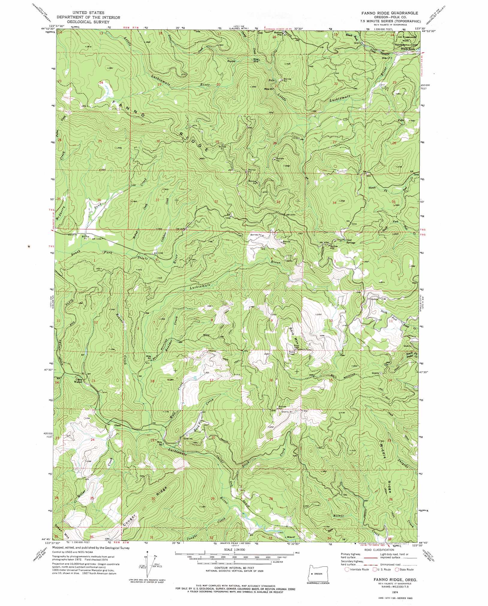
USGS Topo Quad 44123g5 - 1:24,000 scale
| Topo Map Name: | Fanno Ridge |
| USGS Topo Quad ID: | 44123g5 |
| Print Size: | ca. 21 1/4" wide x 27" high |
| Southeast Coordinates: | 44.75° N latitude / 123.5° W longitude |
| Map Center Coordinates: | 44.8125° N latitude / 123.5625° W longitude |
| U.S. State: | OR |
| Filename: | o44123g5.jpg |
| Download Map JPG Image: | Fanno Ridge topo map 1:24,000 scale |
| Map Type: | Topographic |
| Topo Series: | 7.5´ |
| Map Scale: | 1:24,000 |
| Source of Map Images: | United States Geological Survey (USGS) |
| Alternate Map Versions: |
Fanno Ridge OR 1974, updated 1977 Download PDF Buy paper map Fanno Ridge OR 2011 Download PDF Buy paper map Fanno Ridge OR 2014 Download PDF Buy paper map |
1:24,000 Topo Quads surrounding Fanno Ridge
Dolph |
Midway |
Grand Ronde |
Sheridan |
Ballston |
Stott Mountain |
Warnicke Creek |
Laurel Mountain |
Socialist Valley |
Dallas |
Euchre Mountain |
Valsetz |
Fanno Ridge |
Falls City |
Airlie North |
Eddyville |
Nortons |
Summit |
Kings Valley |
Airlie South |
Elk City |
Harlan |
Marys Peak |
Wren |
Corvallis |
> Back to 44123e1 at 1:100,000 scale
> Back to 44122a1 at 1:250,000 scale
> Back to U.S. Topo Maps home
Fanno Ridge topo map: Gazetteer
Fanno Ridge: Ridges
Cougar Ridge elevation 730m 2395′Fanno Ridge elevation 868m 2847′
Middle Ridge elevation 372m 1220′
Fanno Ridge: Springs
Cold Springs elevation 732m 2401′Fanno Ridge: Streams
Beaver Creek elevation 244m 800′Black Rock Creek elevation 229m 751′
Boulder Creek elevation 247m 810′
Callahan Creek elevation 366m 1200′
Camp Creek elevation 409m 1341′
Cougar Creek elevation 170m 557′
Lost Creek elevation 452m 1482′
McFall Creek elevation 361m 1184′
Miller Creek elevation 234m 767′
Rock Pit Creek elevation 227m 744′
Sand Creek elevation 354m 1161′
Slick Creek elevation 182m 597′
Wolf Creek elevation 231m 757′
Fanno Ridge: Summits
Bald Mountain elevation 980m 3215′Fanno Ridge digital topo map on disk
Buy this Fanno Ridge topo map showing relief, roads, GPS coordinates and other geographical features, as a high-resolution digital map file on DVD: