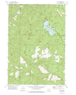
Valsetz Topo Map Oregon
To zoom in, hover over the map of Valsetz
USGS Topo Quad 44123g6 - 1:24,000 scale
| Topo Map Name: | Valsetz |
| USGS Topo Quad ID: | 44123g6 |
| Print Size: | ca. 21 1/4" wide x 27" high |
| Southeast Coordinates: | 44.75° N latitude / 123.625° W longitude |
| Map Center Coordinates: | 44.8125° N latitude / 123.6875° W longitude |
| U.S. State: | OR |
| Filename: | o44123g6.jpg |
| Download Map JPG Image: | Valsetz topo map 1:24,000 scale |
| Map Type: | Topographic |
| Topo Series: | 7.5´ |
| Map Scale: | 1:24,000 |
| Source of Map Images: | United States Geological Survey (USGS) |
| Alternate Map Versions: |
Valsetz OR 1974, updated 1977 Download PDF Buy paper map Valsetz OR 2011 Download PDF Buy paper map Valsetz OR 2014 Download PDF Buy paper map |
1:24,000 Topo Quads surrounding Valsetz
> Back to 44123e1 at 1:100,000 scale
> Back to 44122a1 at 1:250,000 scale
> Back to U.S. Topo Maps home
Valsetz topo map: Gazetteer
Valsetz: Dams
Valsetz Lake Dam (historical) elevation 336m 1102′Valsetz: Falls
Valsetz Falls elevation 225m 738′Valsetz: Flats
Buckskin Flat elevation 488m 1601′Valsetz: Gaps
Big Saddle elevation 679m 2227′Chandler Pass elevation 415m 1361′
Valsetz: Populated Places
Valsetz (historical) elevation 340m 1115′Valsetz: Post Offices
Chandler Post Office (historical) elevation 291m 954′Rocca Post Office (historical) elevation 221m 725′
Valsetz Post Office (historical) elevation 340m 1115′
Valsetz: Reservoirs
Valsetz Lake (historical) elevation 336m 1102′Valsetz: Streams
Beaver Creek elevation 339m 1112′Bend Creek elevation 259m 849′
Blind Creek elevation 204m 669′
Deer Creek elevation 196m 643′
Drift Creek elevation 286m 938′
Falls Creek elevation 195m 639′
Fanno Creek elevation 337m 1105′
Found Creek elevation 336m 1102′
Fourth of July Creek elevation 253m 830′
Handy Creek elevation 336m 1102′
Lucas Creek elevation 201m 659′
McSheery Creek elevation 341m 1118′
Pigeon Creek elevation 287m 941′
Potter Creek elevation 339m 1112′
Rogers Creek elevation 301m 987′
Short Creek elevation 265m 869′
Slate Creek elevation 245m 803′
Whiskey Creek elevation 257m 843′
Young Creek elevation 241m 790′
Valsetz: Summits
Big Tip elevation 861m 2824′Chandler Mountain elevation 584m 1916′
Diamond Peak elevation 741m 2431′
Fanno Peak elevation 1010m 3313′
Green Mountain elevation 860m 2821′
Valsetz digital topo map on disk
Buy this Valsetz topo map showing relief, roads, GPS coordinates and other geographical features, as a high-resolution digital map file on DVD:


