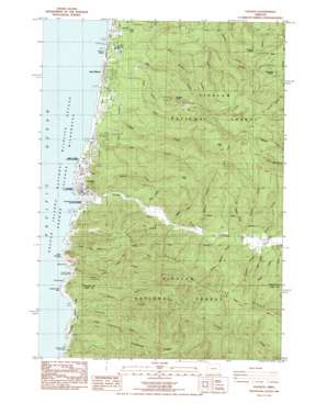
Yachats Topo Map Oregon
To zoom in, hover over the map of Yachats
USGS Topo Quad 44124c1 - 1:24,000 scale
| Topo Map Name: | Yachats |
| USGS Topo Quad ID: | 44124c1 |
| Print Size: | ca. 21 1/4" wide x 27" high |
| Southeast Coordinates: | 44.25° N latitude / 124° W longitude |
| Map Center Coordinates: | 44.3125° N latitude / 124.0625° W longitude |
| U.S. State: | OR |
| Filename: | o44124c1.jpg |
| Download Map JPG Image: | Yachats topo map 1:24,000 scale |
| Map Type: | Topographic |
| Topo Series: | 7.5´ |
| Map Scale: | 1:24,000 |
| Source of Map Images: | United States Geological Survey (USGS) |
| Alternate Map Versions: |
Yachats OR 1984, updated 1985 Download PDF Buy paper map Yachats OR 1984, updated 1985 Download PDF Buy paper map Yachats OR 2011 Download PDF Buy paper map Yachats OR 2014 Download PDF Buy paper map |
| FStopo: | US Forest Service topo Yachats is available: Download FStopo PDF Download FStopo TIF |
1:24,000 Topo Quads surrounding Yachats
Newport South |
Toledo South |
Elk City |
||
Waldport |
Tidewater |
Hellion Rapids |
||
Yachats |
Cannibal Mountain |
Five Rivers |
||
Heceta Head |
Cummins Peak |
Herman Creek |
||
Mercer Lake |
Tiernan |
Mapleton |
> Back to 44124a1 at 1:100,000 scale
> Back to 44124a1 at 1:250,000 scale
> Back to U.S. Topo Maps home
Yachats topo map: Gazetteer
Yachats: Bays
Cooks Chasm elevation 1m 3′Devils Churn elevation 0m 0′
Yachats: Capes
Agate Point elevation 0m 0′Cape Perpetua elevation 3m 9′
Captain Cook Point elevation 0m 0′
Yachats: Forests
Yachats Purchase Unit elevation 325m 1066′Yachats: Gaps
Crotchline Saddle elevation 330m 1082′Desolation Saddle elevation 279m 915′
Yachats: Lakes
Placer Lake elevation 12m 39′Yachats: Parks
Cape Perpetua Special Interest Area elevation 5m 16′Fourmile Camp elevation 362m 1187′
Neptune State Park elevation 91m 298′
San Marine State Park elevation 4m 13′
Smelt Sands State Recreation Site elevation 6m 19′
Yachats Ocean Road State Natural Site elevation 3m 9′
Yachats State Recreation Area elevation 2m 6′
Yachats: Populated Places
San Marine elevation 7m 22′Tillicum Beach elevation 5m 16′
Yachats elevation 12m 39′
Yachats: Post Offices
Yachats Post Office elevation 12m 39′Yachats: Reservoirs
Big Creek Log Pond elevation 13m 42′Yachats: Ridges
Cape Ridge elevation 467m 1532′Dicks Ridge elevation 244m 800′
Kerby Ridge elevation 475m 1558′
Yachats: Streams
Agency Creek elevation 0m 0′Barkley Creek elevation 6m 19′
Beamer Creek elevation 19m 62′
Bend Creek elevation 25m 82′
Big Creek elevation 8m 26′
Cape Creek elevation 0m 0′
Carson Creek elevation 30m 98′
Cedar Creek elevation 6m 19′
Clear Creek elevation 23m 75′
Cummins Creek elevation 0m 0′
Dawson Creek elevation 23m 75′
Dicks Fork elevation 13m 42′
Gender Creek elevation 1m 3′
Gregory Creek elevation 1m 3′
Gwynn Creek elevation 0m 0′
Little Beamer Creek elevation 18m 59′
Little Beaver Creek elevation 20m 65′
Little Cummins Creek elevation 5m 16′
Long Creek elevation 6m 19′
Marks Creek elevation 10m 32′
Mitchell Creek elevation 2m 6′
Nancy Creek elevation 5m 16′
North Cape Creek elevation 6m 19′
Reedy Creek elevation 8m 26′
Reynolds Creek elevation 3m 9′
Salmon Creek elevation 6m 19′
South Beamer Creek elevation 15m 49′
South Fork Big Creek elevation 13m 42′
Spring Creek elevation 7m 22′
Starr Creek elevation 0m 0′
Vingie Creek elevation 0m 0′
Wenner Creek elevation 26m 85′
Wolf Creek elevation 50m 164′
Yachats River elevation 0m 0′
Yachats: Summits
Blodgett Peak elevation 306m 1003′Green Mountain elevation 494m 1620′
Kerby Mountain elevation 513m 1683′
Strawberry Hill elevation 8m 26′
Yachats Mountain elevation 443m 1453′
Yachats digital topo map on disk
Buy this Yachats topo map showing relief, roads, GPS coordinates and other geographical features, as a high-resolution digital map file on DVD:


