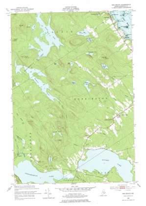
Red Beach Topo Map Maine
To zoom in, hover over the map of Red Beach
USGS Topo Quad 45067a2 - 1:24,000 scale
| Topo Map Name: | Red Beach |
| USGS Topo Quad ID: | 45067a2 |
| Print Size: | ca. 21 1/4" wide x 27" high |
| Southeast Coordinates: | 45° N latitude / 67.125° W longitude |
| Map Center Coordinates: | 45.0625° N latitude / 67.1875° W longitude |
| U.S. State: | ME |
| Filename: | o45067a2.jpg |
| Download Map JPG Image: | Red Beach topo map 1:24,000 scale |
| Map Type: | Topographic |
| Topo Series: | 7.5´ |
| Map Scale: | 1:24,000 |
| Source of Map Images: | United States Geological Survey (USGS) |
| Alternate Map Versions: |
Red Beach ME 1949, updated 1952 Download PDF Buy paper map Red Beach ME 1949, updated 1969 Download PDF Buy paper map Red Beach ME 1949, updated 1978 Download PDF Buy paper map Red Beach ME 2011 Download PDF Buy paper map Red Beach ME 2014 Download PDF Buy paper map |
1:24,000 Topo Quads surrounding Red Beach
Kellyland |
||||
Woodland |
Calais |
Devils Head |
||
Meddybemp Lake West |
Meddybemp Lake East |
Red Beach |
Robbinston |
|
Lake Cathance |
Porcupine Mountain |
Pembroke |
Eastport |
|
Hadley Lake |
Long Lake |
Whiting |
West Lubec |
Lubec |
> Back to 45067a1 at 1:100,000 scale
> Back to 45066a1 at 1:250,000 scale
> Back to U.S. Topo Maps home
Red Beach topo map: Gazetteer
Red Beach: Bars
Half Tide Ledge elevation 0m 0′Red Beach: Bays
Lamb Cove elevation 0m 0′Lowe Cove elevation 6m 19′
Red Beach Cove elevation 0m 0′
Red Beach: Capes
Bunker Point elevation 8m 26′McCurdy Point elevation 6m 19′
Red Beach: Flats
Rocky Meadow elevation 49m 160′Red Beach: Islands
Little Dochet Island elevation 0m 0′Red Beach: Lakes
Coleback Lake elevation 39m 127′Eastern Lake elevation 76m 249′
Goulding Lake elevation 100m 328′
Howard Lake elevation 48m 157′
Keene Lake elevation 59m 193′
Magurrewock Lakes elevation 50m 164′
Moneymaker Lake elevation 71m 232′
Mud Lake elevation 58m 190′
Nashs Lake elevation 50m 164′
Penknife Lakes elevation 119m 390′
Pine Lake elevation 52m 170′
Rand Lake elevation 92m 301′
Rogue Lake elevation 104m 341′
Shattuck Lake elevation 60m 196′
Western Lake elevation 82m 269′
Red Beach: Populated Places
Charlotte elevation 25m 82′Red Beach elevation 29m 95′
Red Beach: Streams
Beaver Brook elevation 12m 39′Dead Meadow Stream elevation 49m 160′
Eastern Stream elevation 16m 52′
Mill Brook elevation 23m 75′
Moosehorn Brook elevation 23m 75′
Ohio Brook elevation 23m 75′
Penknife Brook elevation 23m 75′
Taylor Brook elevation 24m 78′
Red Beach: Summits
Birch Mountain elevation 134m 439′Carlisle Mountain elevation 167m 547′
Hawks Mountain elevation 92m 301′
Howard Lake Mountain elevation 135m 442′
Mount Seeall elevation 147m 482′
Trimble Mountain elevation 156m 511′
Red Beach digital topo map on disk
Buy this Red Beach topo map showing relief, roads, GPS coordinates and other geographical features, as a high-resolution digital map file on DVD:
Maine, New Hampshire, Rhode Island & Eastern Massachusetts
Buy digital topo maps: Maine, New Hampshire, Rhode Island & Eastern Massachusetts


