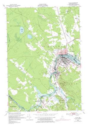
Calais Topo Map Maine
To zoom in, hover over the map of Calais
USGS Topo Quad 45067b3 - 1:24,000 scale
| Topo Map Name: | Calais |
| USGS Topo Quad ID: | 45067b3 |
| Print Size: | ca. 21 1/4" wide x 27" high |
| Southeast Coordinates: | 45.125° N latitude / 67.25° W longitude |
| Map Center Coordinates: | 45.1875° N latitude / 67.3125° W longitude |
| U.S. State: | ME |
| Filename: | o45067b3.jpg |
| Download Map JPG Image: | Calais topo map 1:24,000 scale |
| Map Type: | Topographic |
| Topo Series: | 7.5´ |
| Map Scale: | 1:24,000 |
| Source of Map Images: | United States Geological Survey (USGS) |
| Alternate Map Versions: |
Calais ME 1949, updated 1952 Download PDF Buy paper map Calais ME 1949, updated 1952 Download PDF Buy paper map Calais ME 1949, updated 1978 Download PDF Buy paper map Calais ME 2011 Download PDF Buy paper map Calais ME 2014 Download PDF Buy paper map |
1:24,000 Topo Quads surrounding Calais
> Back to 45067a1 at 1:100,000 scale
> Back to 45066a1 at 1:250,000 scale
> Back to U.S. Topo Maps home
Calais topo map: Gazetteer
Calais: Bridges
International Bridge elevation 3m 9′Calais: Capes
Pratt Point elevation 25m 82′Calais: Dams
Barn Meadows Cross Dike elevation 23m 75′Middle Magurrewock Dam elevation 23m 75′
Milltown Power Station Dam elevation 12m 39′
Popple Flowage Dam elevation 40m 131′
Upper Magurrewock Dam elevation 23m 75′
Calais: Islands
Haywood Island elevation 25m 82′McKeesick Island elevation 22m 72′
Sawdust Island elevation 20m 65′
Calais: Parks
Calais Historic District elevation 17m 55′Thomas DiCenzo Athletic Complex elevation 32m 104′
Calais: Populated Places
Baring elevation 27m 88′Calais elevation 13m 42′
Milltown elevation 19m 62′
Saint Croix Junction elevation 23m 75′
Calais: Post Offices
Calais Post Office elevation 19m 62′Calais: Rapids
Bailey Rips elevation 23m 75′Calais: Reservoirs
Middle Magurrewock Marsh elevation 23m 75′Popple Flowage elevation 40m 131′
Saint Croix River Reservoir elevation 12m 39′
Upper Barn Meadow Marsh elevation 23m 75′
Upper Magurrewock Marsh elevation 23m 75′
Calais: Streams
Conic Stream elevation 23m 75′East Branch Magurrewock Stream elevation 24m 78′
Magurrewock Stream elevation 18m 59′
Stony Brook elevation 23m 75′
Calais: Summits
Magurrewock Mountain elevation 116m 380′Calais digital topo map on disk
Buy this Calais topo map showing relief, roads, GPS coordinates and other geographical features, as a high-resolution digital map file on DVD:
Maine, New Hampshire, Rhode Island & Eastern Massachusetts
Buy digital topo maps: Maine, New Hampshire, Rhode Island & Eastern Massachusetts


