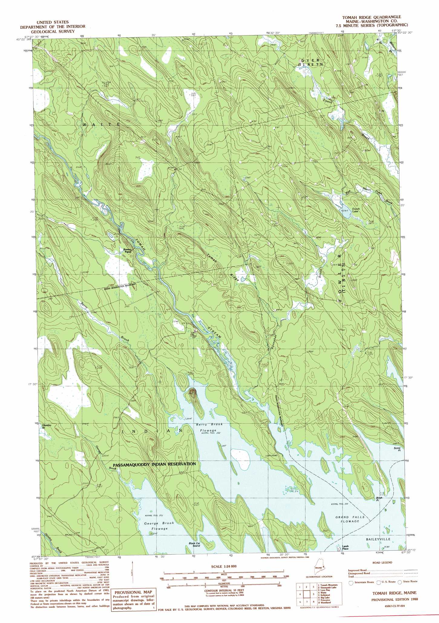
Toman Ridge Topo Map Maine
To zoom in, hover over the map of Toman Ridge
USGS Topo Quad 45067c5 - 1:24,000 scale
| Topo Map Name: | Toman Ridge |
| USGS Topo Quad ID: | 45067c5 |
| Print Size: | ca. 21 1/4" wide x 27" high |
| Southeast Coordinates: | 45.25° N latitude / 67.5° W longitude |
| Map Center Coordinates: | 45.3125° N latitude / 67.5625° W longitude |
| U.S. State: | ME |
| Filename: | o45067c5.jpg |
| Download Map JPG Image: | Toman Ridge topo map 1:24,000 scale |
| Map Type: | Topographic |
| Topo Series: | 7.5´ |
| Map Scale: | 1:24,000 |
| Source of Map Images: | United States Geological Survey (USGS) |
| Alternate Map Versions: |
Tomah Ridge ME 1988, updated 1988 Download PDF Buy paper map Tomah Ridge ME 2011 Download PDF Buy paper map Tomah Ridge ME 2014 Download PDF Buy paper map |
1:24,000 Topo Quads surrounding Toman Ridge
Brookton |
Forest |
Lambert Lake |
Vanceboro |
|
Farrow Mountain |
Tomah Mountain |
Simsquish Lake |
Loon Bay |
|
Oxbrook Lakes |
Waite |
Toman Ridge |
Kellyland |
|
Grand Lake Stream |
Big Lake |
Princeton |
Woodland |
Calais |
Monroe Lake |
Clifford Lake |
Crawford Lake |
Meddybemp Lake West |
Meddybemp Lake East |
> Back to 45067a1 at 1:100,000 scale
> Back to 45066a1 at 1:250,000 scale
> Back to U.S. Topo Maps home
Toman Ridge topo map: Gazetteer
Toman Ridge: Capes
Birch Point elevation 61m 200′Toman Ridge: Dams
Kennebec Dam (historical) elevation 79m 259′Toman Ridge: Islands
Black Cat Island elevation 65m 213′Toman Ridge: Lakes
Berry Brook Flowage elevation 61m 200′Enoch Lake elevation 85m 278′
George Brook Flowage elevation 61m 200′
Toman Ridge: Populated Places
Lamb Place elevation 64m 209′Toman Ridge: Ridges
Tomah Ridge elevation 91m 298′Toman Ridge: Streams
Berry Brook elevation 61m 200′George Brook elevation 63m 206′
Kennebec Brook elevation 61m 200′
Tomah Stream elevation 61m 200′
West Branch Millberry Brook elevation 70m 229′
Toman Ridge digital topo map on disk
Buy this Toman Ridge topo map showing relief, roads, GPS coordinates and other geographical features, as a high-resolution digital map file on DVD:
Maine, New Hampshire, Rhode Island & Eastern Massachusetts
Buy digital topo maps: Maine, New Hampshire, Rhode Island & Eastern Massachusetts