Lagrange Topo Map Maine
To zoom in, hover over the map of Lagrange
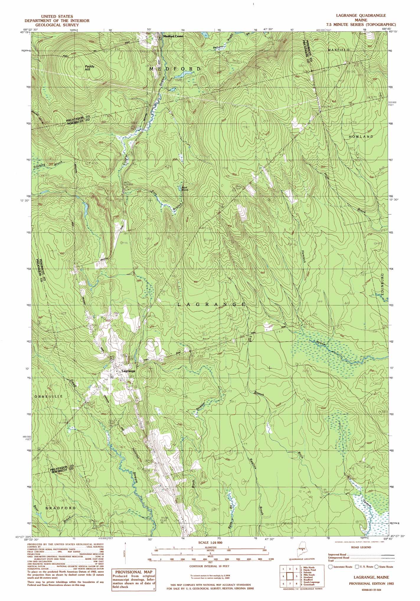
USGS Topo Quad 45068b7 - 1:24,000 scale
| Topo Map Name: | Lagrange |
| USGS Topo Quad ID: | 45068b7 |
| Print Size: | ca. 21 1/4" wide x 27" high |
| Southeast Coordinates: | 45.125° N latitude / 68.75° W longitude |
| Map Center Coordinates: | 45.1875° N latitude / 68.8125° W longitude |
| U.S. State: | ME |
| Filename: | o45068b7.jpg |
| Download Map JPG Image: | Lagrange topo map 1:24,000 scale |
| Map Type: | Topographic |
| Topo Series: | 7.5´ |
| Map Scale: | 1:24,000 |
| Source of Map Images: | United States Geological Survey (USGS) |
| Alternate Map Versions: |
Lagrange ME 1978, updated 1981 Download PDF Buy paper map Lagrange ME 1983, updated 1984 Download PDF Buy paper map Lagrange ME 2011 Download PDF Buy paper map Lagrange ME 2014 Download PDF Buy paper map |
1:24,000 Topo Quads surrounding Lagrange
Ebeemee Mountain |
Seboeis Lake |
Endless Lake |
Mattamiscontis Mountain |
Nine Meadow Ridge |
Brownville Junction |
Milo North |
Hardy Pond |
Seboeis |
Lincoln West |
South Sebec |
Milo South |
Lagrange |
Howland |
Passadumkeag |
Charleston |
Bradford |
South Lagrange |
Greenbush |
Olamon |
West Corinth |
Kenduskeag |
Pushaw Lake |
Old Town |
Otter Chain Ponds |
> Back to 45068a1 at 1:100,000 scale
> Back to 45068a1 at 1:250,000 scale
> Back to U.S. Topo Maps home
Lagrange topo map: Gazetteer
Lagrange: Populated Places
Lagrange elevation 88m 288′Medford Center elevation 86m 282′
Lagrange: Streams
Bear Brook elevation 48m 157′Lagrange: Summits
Paddy Hill elevation 160m 524′Lagrange digital topo map on disk
Buy this Lagrange topo map showing relief, roads, GPS coordinates and other geographical features, as a high-resolution digital map file on DVD:
Maine, New Hampshire, Rhode Island & Eastern Massachusetts
Buy digital topo maps: Maine, New Hampshire, Rhode Island & Eastern Massachusetts